The capsized wreck of a seaplane is floating in Husavågen, presenting an obstruction near estimated position:
59° 59.5′ N, 5° 48.2′ E (WGS84)
The wreck is unmarked. All shipping should keep clear.
See also: NRK, 29 July 2022
]]>60° 00.532′ N, 5° 48.423′ E, depth 21 (21 m) ]]>
60° 00.677′ N, 5° 48.785′ E, (a)
60° 00.652′ N, 5° 48.825′ E, (b)
Delete 3 overhead cables (symbol D26) close by at position:
60° 00.68′ N, 5° 48.83′ E
60° 00.66′ N, 5° 48.81′ E ]]>
 Y (symbol Q130.6; yellow special buoy) ODAS (symbol Q58; data collecting buoy) in position:
60° 00′ 28.8″ N, 5° 48′ 43.8″ E ]]>
Amend colour of sector 285°–291° to green.
Insert sector limit 4.5° and delete sector limit 7° close by.
Remark: Light character and remaining sectors unchanged; see enclosed sketch of the new sector configuration. New sector limit 4.5° intersects the southern neatline of chart 61 at 4° 59.90′ W of Oslo.
Position:
60° 00.08′ N, 4° 59.63′ W of Oslo (NGO48, chart 61)
60° 00.12′ N, 5° 43.48′ E of Greenwich (WGS84, chart 61G)

Source: Kystinfo, navigasjonsinstallasjoner fra Nautisk fagsystem / Norsk Fyrliste (145200), Kystverket, 6 December 2021
]]> Q.R (symbols P10.6 and P11.2; continuous quick, red) in position:
60° 21.70′ N, 5° 00.24′ W of Oslo, (Sandsøya N)
Source: Norsk Fyrliste (145202), Kystverket, 6 December 2021
]]>60° 00.59′ N, 5° 48.39′ E (WGS84)
Cancel Navigational Warning 2021-24.
]]>Please note that owing to the age and quality of the source information, some detail on this chart may not be positioned accurately. Particular caution is advised when navigating in the vicinity of dangers or shoal areas, even when using an electronic positioning system such as GPS.
Scale: 1:20000
Format: ISO A4
Datum: WGS84
Small corrections: 17 May 2021
Corner coordinates:
59° 58.50′ N, 5° 46.40′ E of Greenwich (SW corner)
60° 01.10′ N, 5° 50.00′ E of Greenwich (NE corner)
This chart is free content, licensed for reuse under the terms of CC-BY 4.0.
Permalink to download the current edition: arne.johannessen.de/charts/63 (PDF)
© Arne Johannessen
 between positions:
59° 59.95′ N, 5° 47.75′ E (Tråvik)
59° 59.93′ N, 5° 47.80′ E
59° 59.92′ N, 5° 48.70′ E (Grønnevika)
Move  from 59° 59.90′ N, 5° 48.20′ E to:
59° 59.80′ N, 5° 48.10′ E
Cancel NM 2021-10 (T).
Sources: Efs 09/21 (64548 *) and chart NO4F1011, Kartverket Norway, Stavanger, 12 May 2021
]]> between positions:59° 59.92′ N, 4° 55.37′ W of Oslo (Traavik)
59° 59.89′ N, 4° 55.28′ W of Oslo
59° 59.88′ N, 4° 54.40′ W of Oslo (Grönnevika)
Move from 59° 59.86′ N, 4° 54.97′ W to:
59° 59.75′ N, 4° 54.97′ W of Oslo
Cancel NM 2021-8 (T).
Sources: Efs 09/21 (64548 *) and chart NO4F1011, Kartverket Norway, Stavanger, 12 May 2021
]]>The Pontoon at the Dalsjøen general store is damaged and unusable.
60° 00.59′ N, 5° 48.39′ E (WGS84)
Please note that the age and quality of most of the hydrographic source information used to compile this first edition of chart 62 is not satisfactory by modern survey standards. Official Norwegian paper charts are also not satisfactory within the area of this chart due to their small scale. Mariners should consider using Electronic Navigational Chart (ENC) NO4F1011 “Kvinnheradsfjorden” in addition to this chart, particularly on deep-draft vessels.
Scale: 1:5000
Format: ISO A4
Datum: ETRS89 (WGS84 compatible)
Small corrections: 30 April 2021
Corner coordinates:
60° 00′ 22″ N, 5° 48′ 09″ E of Greenwich (SW corner)
60° 00′ 48″ N, 5° 49′ 30″ E of Greenwich (NE corner)
Small corrections: 27 April 2021
]]>59° 59.8′ N, 005° 47.6′ E, (a, clearance 6.5 m)
60° 01.0′ N, 005° 49.9′ E, (b, clearance 10 m)
Remark: The overhead cable with clearance 9 m close by (b) remains unchanged.
]]>59° 59.8′ N, 004° 55.5′ W of Oslo, (a, clearance 6.5 m)
60° 01.0′ N, 004° 53.2′ W of Oslo, (b, clearance 10 m)
Remark: The overhead cable with clearance 9 m close by (b) remains unchanged.
]]>Insert  joining positions (a)–(b) and (c)–(d):
59° 59.8′ N, 5° 47.8′ E (a)
59° 59.8′ N, 5° 48.8′ E (b)
60° 60.1′ N, 5° 48.0′ E (c)
60° 60.0′ N, 5° 58.7′ E (d)
Insert legend Works in progress (2021) (symbol F32) between maritime limits above.
See also navigational warning 2021-6.
]]>Insert joining positions (a)–(b) and (c)–(d):
59° 59.7′ N, 4° 55.3′ W of Oslo (a)
59° 59.7′ N, 4° 54.3′ W of Oslo (b)
60° 60.1′ N, 4° 55.1′ W of Oslo (c)
60° 60.0′ N, 4° 54.4′ W of Oslo (d)
Insert legend Under arbeid (2021) (symbol F32) between maritime limits above.
See also navigational warning 2021-6.
]]>Submarine power cables and water supply pipelines are being constructed in Husavågen. Once completed, they are meant to run between Tråvik and Grønnevika.
Several work vessels may operate in the vicinity of position 59° 59.9′ N, 5° 48.3′ E (WGS84). They may display ball–diamond–ball or other signals according to COLREGS. Work vessels include:
- ALPHA, call sign LG2502
- NAUTILUS MAXI, call sign LM5881
- SJØBAS, call sign JXTC
Mariners are cautioned against all seabed activities in the works area, particularly fishing and use of the recommended anchorage close by.
]]>60° 00.7′ N, 5° 48.8′ E (WGS84)
]]>Changes in this New Edition:
- New plan: Dalsjøen (1:2000)
- New plan: Tråvik (1:2000)
- Existing plans have been refined with new information that has been received.
- Graduation has been added to existing plans.
- Plan A “Berge” has been renamed “Øyro”.
This chart is free content, licensed for reuse under the terms of CC-BY-ND 4.0.
Permalink to download the current edition: arne.johannessen.de/charts/64 (PDF)
© Arne Johannessen
This New Edition cancels the previous edition (published in 2015). However, it does not contain any changes significant to navigation, therefore it does not make the 2015 edition obsolete and it may safely be treated as a Revised Reprint by pleasure craft not required by law to carry up-to-date official charts (e. g. Forskrift om navigasjonshjelpemidler / SchSV Anlage 1 C.I.4.3.).
Comprehensive list of changes in this (Limited) New Edition:
- All issued official Norwegian Efs up to and including Efs 07/19 have been applied.
- Magnetic variation has been updated (see also NM 2020-25
 T).
- 53 topographic names have been added, removed, completely replaced, or otherwise considerably changed.
- 128 topographic names have undergone minor spelling changes.
- The coastline in the harbour of Eidsvik (Halsnøya) has been slightly refined.
While the 2015 edition may safely continue to be used for navigation, obtaining this updated version of chart NO20 is still recommended even for pleasure craft: Occasionally geographical names are spoken or spelled (for example when reporting positions by radiotelephone), and it is useful that all parties involved in such communication use the same reference for such names. Considering that, it would seem sensible for all chart users to obtain this New Edition at their earliest convenience in spite of the lack of changes significant to navigation.
Sources:
- Efs 08/19 (60166 *), Kartverket Norway, 30 April 2019
- Differential image analysis of chart NO 20, comparing PODs dated 6 July 2018 and 10 May 2019.
59° 58.3′ N, 5° 34.5′ E
59° 44.9′ N, 5° 34.9′ E
59° 54.0′ N, 5° 50.3′ E
59° 48.2′ N, 6° 02.8′ E
59° 37.2′ N, 5° 58.1′ E
Valid 2020–2024.
Source: WMM2020, NOAA, Washington DC, 10 December 2019
]]>59° 58.45′ N, 4° 57.10′ W of Oslo
Source: Norsk fyrliste, Kystverket Vest, Haugesund, 25 May 2020
]]> Q.G (priv) (symbols P10.6, P11.3 and P65; quick-flashing, green, privately maintained) in position:
60° 00.3′ N, 5° 41.8′ E
Source: Efs 03/18 (58438 * / Tracing), Kartverket Norway, Stavanger, 15 February 2018
]]>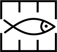 in positions:
59° 59.5′ N, 4° 58.9′ W of Oslo
59° 59.4′ N, 4° 58.0′ W of Oslo
Source: Efs 07/17 (57059 *), Kartverket Norway, Stavanger, 15 April 2017
]]> in positions:59° 59.5′ N, 5° 44.2′ E
59° 59.4′ N, 5° 45.1′ E
Source: Efs 07/17 (57059 *), Kartverket Norway, Stavanger, 15 April 2017
]]>This first edition includes plans for:
- Berge (1:2000)
- Korshamn (1:2000)
- Korshamn berths (1:1000)
Format: ISO A4
Datum: WGS84
Small corrections: 31 December 2019
Approximate location: 60° 00′ N, 5° 48′ E
This chart is free content, licensed for reuse under the terms of CC-BY-ND 4.0.
Permalink to download the current edition: arne.johannessen.de/charts/64 (PDF)
© Arne Johannessen
Comprehensive list of changes in this (Limited) New Edition:
- All issued official Norwegian Efs up to and including Efs 23/15 have been applied.
- NM 2016-11 Skånevikfjorden: Cables
- NM 2016-13 Skånevikfjorden, Etnefjorden: Submarine pipelines
- NM 2016-15 Kvinnheradsfjorden: Ferry route
- NM 2016-17 Langenuen: Depths
- NM 2016-19 Ålfjorden: Rock
- NM 2016-21 Etnefjorden: Quay depths, jetty
- NM 2016-23 Chart NO 20: Source Diagram, Inset
- NM 2016-25 Kvinnheradsfjorden: Marine farms
- NM 2016-27 Onarheimsfjorden: Overhead cables
- NM 2016-29 Ølsfjorden: Submarine cable
- The chart features the new layout of the Kartverket POD series.
- Other minor changes not relevant to navigation are included.
If all Efs and all of the NM listed above are applied to the 2011 reprint of the obsolete 2007 edition, it can continue to be used for navigation. Please note that the official Norwegian Efs must be used to keep chart NO 20 up to date.
Sources:
- Efs 24/15 (54659 *), Kartverket Norway, 31 December 2015
- Differential image analysis of chart NO 20, comparing PODs dated 7 July 2015, 22 December 2015 and 9 September 2016 with the traditionally printed versions from 2007 and 2011.
between positions:59° 36,02′ N, 005° 44,90′ E (Gjerdavik)
59° 36,18′ N, 005° 45,00′ E
59° 36,22′ N, 005° 45,37′ E (Berge)
Source: Print on Demand (POD) of chart NO 20, Kartverket Norway, 9 September 2016
Remark: Certain copies only.
]]>59° 55,25′ N, 005° 40,01′ E
59° 55,41′ N, 005° 40,95′ E (Seløya)
59° 55,52′ N, 005° 41,86′ E (Midtøya)
Source: Print on Demand (POD) of chart NO 20, Kartverket Norway, 9 September 2016
Remark: Certain copies only.
]]> close by:59° 57,09′ N, 005° 49,32′ E (a)
59° 57,03′ N, 005° 49,49′ E
59° 57,29′ N, 005° 49,87′ E
59° 57,35′ N, 005° 49,70′ E
59° 57,09′ N, 005° 49,32′ E (a)
Insert 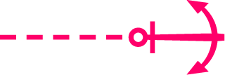 from the marine farm above to each of the following positions:
59° 57,22′ N, 005° 50,19′ E
59° 57,63′ N, 005° 50,45′ E
59° 57,75′ N, 005° 50,15′ E
59° 57,60′ N, 005° 48,99′ E
59° 57,34′ N, 005° 48,62′ E
59° 56,82′ N, 005° 48,73′ E
59° 56,75′ N, 005° 48,94′ E
Delete in position:
59° 56,9′ N, 005° 49,6′ E
Source: ENC NO4H0911, Kartverket Norway, 9 September 2016
Remark: Certain copies only.
Note: Additional ground tackles exist. The tackles listed above have been selected such that the extreme extent is charted. See the ENC for the full detail.
]]>59° 51,7′ N, 006° 16,6′ E
Amend reference to continuation on inset plan to read Continued on plan (A) (symbol “circled A”) in position:
59° 47,6′ N, 006° 09,8′ E (main chart border)
Insert the accompanying block, replacing part of the source diagram.

Image size: 31,4 × 72,8 mm²
Replace source diagram legend and note “CAUTION – The date of survey …“ with the following legend:
[magenta] Surveying 1932–1940, lead-line. Incomplete old surveys. Depth anomalies may be expected. Great care shoud therefore been exercised when navigating in these waters.
[green] Surveying 1981–2003, single-beam echosounder. Uncharted features hazardous to surface navigation are not expected, but may exist.
[blue] Surveying 1981–2003, multi-beam echosounder. All significant seafloor features detected.
Source: Print on Demand (POD) of chart NO 20, Kartverket Norway, 9 September 2016
Remark: Certain copies only.
]]>59° 40,12′ N, 005° 55,80′ E, depth 3 (3 m) (Etne)
59° 40,20′ N, 005° 55,77′ E, depth 5 (5 m)
Insert jetty (symbol F14):
59° 39,80′ N, 005° 55,77′ E (Sæbø)
59° 39,83′ N, 005° 55,73′ E
Source: Print on Demand (POD) of chart NO 20, Kartverket Norway, 9 September 2016
Remark: Certain copies only.
Note: Etnepollen has been resurveyed east of 5° 55,4′ E and full bottom coverage has been achieved. Aside from the quay depths provided above, the resulting chart update is not considered to be of relevance for safe navigation. It is available via Print on Demand (POD) in chart NO 20, Kartverket Norway.
]]> (39) (least depth 3.9 m) in position:
60° 00,78′ N, 005° 49,30′ E (Vikevik)
Source: Print on Demand (POD) of chart NO 20, Kartverket Norway, 9 September 2016
Remark: Certain copies only.
]]>59° 53,27′ N, 005° 34,68′ E, depth 14 (14 m) (Kvitesalen)
59° 46,75′ N, 005° 31,86′ E, depth 15 (15 m) (Ytstøy)
Source: Print on Demand (POD) of chart NO 20, Kartverket Norway, 9 September 2016
Remark: Certain copies only.
]]>60° 01,1′ N, 005° 59,7′ E (Løfallstrand)
Source: New Edition (NE) of chart NO 22, Kartverket Norway, 10 December 2015
]]>59° 43,87′ N, 005° 42,13′ E (Borgundøya)
59° 43,92′ N, 005° 42,11′ E
Insert submarine pipeline (symbol L41.1) between positions:
59° 44,58′ N, 005° 56,08′ E (Trønskeneset)
59° 44,57′ N, 005° 56,05′ E
Insert submarine pipeline (symbol L41.1) between positions:
59° 38,90′ N, 005° 55,00′ E (Vågen)
59° 38,85′ N, 005° 55,02′ E
Source: Print On Demand (POD) of chart NO 20, Kartverket Norway, 9 September 2016
Remark: Certain copies only.
]]> between positions:59° 42,60′ N, 005° 50,70′ E (Lauvvik)
59° 42,81′ N, 005° 50,65′ E (Taraldsøya)
Delete overhead cable (symbol D26) between positions:
59° 43,2′ N, 005° 51,1′ E (Taraldsøya)
59° 43,3′ N, 005° 51,5′ E (Molnessund)
Source: Revised Reprint of chart NO 20, Kartverket Norway, 26 July 2011
Remark: Certain copies only.
]]>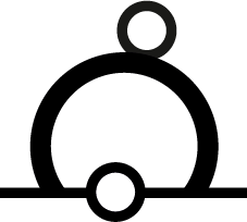 r. (Zeichen P11.2; Farbe gelb) von Position
51° 04,59′ N, 007° 33,77′ E, DHDN90
nach Position
51° 04,651′ N, 007° 33,823′ E, DHDN90
und streiche Zeichen PA (Zeichen B7; Position angenähert).
Streiche r. PA (Zeichen P11.2 + B7; Farbe rot, Position angenähert) auf Position
51° 04,58′ N, 007° 33,74′ E, DHDN90
Quelle: SKGB, 25. September 2016
]]>