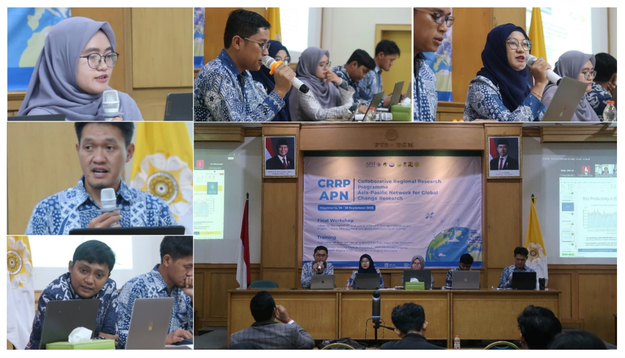
The event was officially opened by the Head of DTPB FTP UGM, Prof. Lilik Sutiarso, who delivered his welcoming address and emphasized the importance of cross-country collaboration in addressing the challenges of climate change and land degradation on food security.
The workshop consisted of two main sessions. The first session was the presentation of collaborative research findings by the CRRP–APN DTPB FTP UGM Team under the leadership of Dr. Chandra Setyawan, S.T.P., M.Sc. The team, consisting of Dr. Chandra Setyawan (team leader), Dr. Ansita Gupitakingkin Pradipta, Dr. Muhamad Khoiru Zaki, Dr. Andri Prima Nugroho, and Isnaini Dairina, M.Sc., presented their research achievements on smart irrigation water management as an adaptation strategy to climate change in support of sustainable food systems.
The second session was a guest lecture moderated by Dr. Ngadisih, featuring four distinguished national and international speakers:
- Dr. Sushil Kumar Himanshu (Asian Institute of Technology, Thailand)
- Dr. Ha Thi Hoa (Thai Nguyen University of Agricultural and Forestry, Vietnam)
- Dr. Dede Sulaeman (Ministry of Agriculture, Republic of Indonesia)
- Propezite Nurhutama M., S.T., M.T. (Ministry of Public Works, Republic of Indonesia)
The speakers shared their perspectives on climate change adaptation strategies, irrigation technology innovations, and sustainable agricultural and infrastructure policies relevant to the Southeast Asian context
This activity aligns with several Sustainable Development Goals (SDGs), particularly:
- SDG 2 (Zero Hunger): strengthening food security through adaptive and efficient irrigation systems,
- SDG 6 (Clean Water and Sanitation): promoting sustainable water resource management,
- SDG 13 (Climate Action): developing research-based adaptation strategies to address the impacts of climate change,
- SDG 17 (Partnerships for the Goals): enhancing academic, research, and policy collaboration across nations.
Through this workshop, DTPB FTP UGM not only expanded its international collaboration networks and strengthened research capacity in the field of smart irrigation but also demonstrated its academic and research competence in making tangible contributions toward building more resilient, adaptive, and sustainable agricultural and food systems at both national and regional levels.
]]>
This guidance was arranged based on case studies in tropical country of Indonesia. Some water resources development programs were developed as a cooperation partnership between the Department of Agricultural and Biosystems Engineering, Faculty of Agricultural Technology, Universitas Gadjah Mada, Indonesia and the Main Office of Serayu Opak Rivers (BBWS.SO), Ministry of Public Works, Indonesia as the fund provider. Various approach methods were used by considering local conditions. We hope this guidance provides some useful references for society to support water resources development programs. Link for download is here
]]> Growth of Population and also changes of food consumption due to agricultural development, trade policies, urbanization, industrialization and others are causing increasing of water demand. Water should be available in adequate quantities and good quality. The effort to comply water demand for various needs is became an important issue especially in many developing countries. In around of the 1980, water supply in most of the developing countries were facing problems of quality and quantity. In 1990 many countries started to reform their water supply and sanitation service by involving private sector through scheme of public private partnerships (PPP).
In PPP, the government play important role in identifying the service needs of water supply, determine the desired output and convey a particular project to the private sector companies. Innovative strategies is needed by the private sector to ensure that they can complete the responsibilities in water supply service.

Urban Populations Served in Developing Countries, 1991–2007
In the period of 1991 to 2000, the water supply served by private sectors in developing countries grew steadily from 6 million to 94 million. The population served by private water operators in developing and emerging countries has continued to increase steadily, from 94 million in 2000 to more than 160 million by the end of 2007. In 2007, private water operators from developing countries were serving about 67 million people (more than 40 percent of the market). There were more than 220 active water PPP in 41 developing and emerging countries (Marin, 2009).

Value Chain of PPP Project in Water Supply
Thus far, the PPP scheme in water supply increase rapidly in many developing countries. PPP’s success will produce a good value chain. Success of those scheme can be achieved through hard efforts because of the complexity of the scheme and future uncertainties in water demands and source availability. Improving the infrastructure and provide universal access is required as basic services in water supply. The role of local operators is very important because each country has their own constraint and different each others. The value chain of water supply is mainly composed of three parts (i) Sourcing, treatment and transmission, (ii) Distribution and (iii) Waste Water treatment (Aziz & Shah, 2012).
Selecting an appropriate strategy of private sector participation in form of management contracts is an important step and could be the key of success in the project identification stage. Detailed process of the strategy that includes exhaustive assessment of existing infrastructure, current performance on service delivery benchmarks, and the technical, operational and financial capability needs to be developed. Through PPP, private operators have improved operational efficiency, quality of service, area of coverage and access to water services.
References:
Aziz, A. & Shah, S.K. (2012). Public Private Partnerships in Urban Water Supply: Potential and Strategies. Chennai: Athena Infonomics India Pvt. Ltd
Marin, P. (2009). Public-Private Partnerships for Urban Water Utilities: A Review of Experiences in Developing Countries. Washington, DC: The World Bank.
]]>

Map of Gintung Sub-Watershed
Landslide is the most damaging natural hazards in hilly and/or mountainous terrain environments. It becomes one of significant hazards in Indonesia. Steep slopes as the dominant topography construct Indonesia to prone to landslides. Moreover, high rainfall intensities enable to trigger the slope stability failure in particular sites. Consequently, Indonesia’s characteristics could create landslides easily.
One of areas frequently suffered by landslides is Gintung Sub-Watershed. Gintung Sub-Watershed (1,452.68 ha) is located in Purworejo Regency, among three districts such as Loano, Purworejo, and Kaligesing. Karnawati (2005) stated that Purworejo Regency has a high potential of landslides. Some of them were located in Gintung Sub-Watershed boundary. Numerous events in the study area could be used as the main indicator of high landslide potential.
Landslide occurrences are the proof that soil becomes insecure. Soil is anisotropic natural bodies (Schlichting, 1982; Sommer & Schlichting, 1996) which has specific capability on accommodating any activities on its surface. The number of landslide could be worse when land use activities do not fit with soil capability. Soil becomes the principal object of landslide event except slopes. The properties of soils vary with direction in catena. Assessment of the soil landscape sensitivity to further change must also take into account in both space and time.
Impacts of human activity are superimposed on soil properties changes. Soil dynamically changes either mechanically or chemically. Human impacts are most related to changing patterns of land use. Improper land uses could aggravate landslide potential. The significant condition of the study is the result of human-induced contributions for destabilizing slopes and threatening soil sustainability.
Appropriate land use planning becomes one of soil conservation strategies. Setting down a good recommendation of land use activities is a crucial aspect in soil sustainability consideration. The conservation guidelines could be made according to landslides distribution in the study area. Therefore, applying soil conservation strategy is expected to be a consideration for reducing significant landslide in that particular area.
Survey method was conducted to collect landslides distribution data. Direct checking to the field and gaining data from the institutions were carried out in this method. The aspects measured on field survey were landslide morphometric and landslide position. Moreover, map interpretation was also conducted to produce the tentative map. Topographycal map, geologycal map, and soil map were used to assist field surveying.
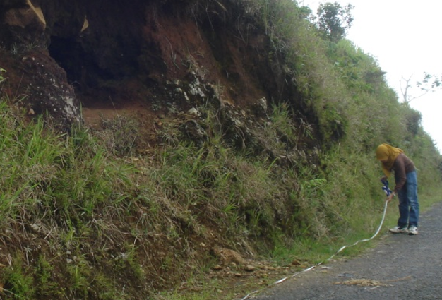
Landslide Morphometric and Position Measurement
Gintung Sub-Watershed has five main types of land use. Types of land use existed in the study area consist of bush, garden, paddy field, settlement, and dryland agriculture. Among those five land uses, garden is the most dominated land use in the study area. Almost the entire area of Gintung Sub-Watershed is covered by garden. There is 68% of Gintung Sub-Watershed covered by garden.
The highest of number density and area density of landslide is on settlement, 6.41 number/km2 and 79.21 millage. Landslide on the settlement area usually occurs along the road network. There is a lot of cutting slope for road construction, which is not suitable to the slope characteristic. This situation could aggravate slope failures, especially settlement on the steep relief. The steep slope area is easy to create prone slope stability. Therefore, steep slope enable to make landslide more intensive.

Steep Slope with Lithic Soil
The biggest number of landslide occurred on the garden, 45 points. Garden as the most dominated land uses should be developed by appropriate conservation strategy to keep the stability of slopes. Otherwise, the steep slope is easily to produce landslide prone area. The large area of garden makes its density of landslide is less dense than settlement.
Regarding to the cultivated land, paddy field has higher area density of landslide than dry land agriculture and bush have. This condition is caused by paddy field has greater wide area and wider landslide areas over dry land agriculture and bush. However, number density of landslide on paddy field is lower than the others. Therefore, based on this situation, it could be stated that the amount of landslides in particular variable class has not yet showed the wide area of landslide.

Proposed land uses for Gintung Sub-Watershed
Appropriate land use planning becomes one of soil conservation strategies from landslide impact. The changing in proposed land uses is occurred for other uses except settlement. The strategy to propose the land uses should be adjusted with the physical characteristics of particular area. Some gardens located in a lower slope should be changed into dryland agriculture, especially tumpangsari technique. In the upper slope of hilly, garden should be changed into conservative forest. In the middle slope of hilly, garden would be appropriate if it combines with shrub and bush. In addition, paddy field is appropiate to be planted in a flat up to undulating area.
Source:
Nur Ainun Pulungan, Chandra Setyawan, Sekar Jatiningtyas, Junun Sartohadi, Soil Conservation Strategy for Potentially Landslide Areas In Gintung Sub-Watershed, Central Java Province, Indonesia. Proceeding of International Symposium on Agricultural and Biosystem Engineering, Yogyakarta 2013.
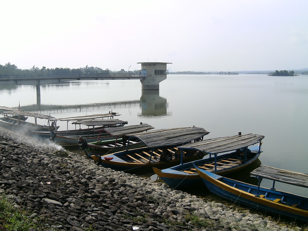
Cacaban Reservoir
Cacaban dam is located at Tegal district Central Java Province. The dam is the strategic asset that play a crucial role in providing water for supplying water irrigation (to irrigate 7439 ha of land), flood control and fisheries. Total area of the upper watershed of Cacaban dam is 60.66 km2. Storage capacity of the dam is 90 million m3.
The current condition, land degradation in the upper area of the dam has increased. The degradation caused by excessive farming activity. Sedimentation flowing from the upper watershed to the dam has increased significantly. It implies water storage capacity of the dam become decreasing. In the same time, water demand for irrigating land is getting high especially in the second planting date (PD-2) where the season is moving from the wet season to the dry season and in the third planting date (PD-3) in dry season.
Using high variety of rice by the farmers with shorter age and higher water consumptive use comparing the usual variety of rice gives contribution in increasing water demand of irrigation. Therefore, recalculation of water balance of the Cacaban dam irrigation system is needed.
Hydrologic analysis was used to recalculate water balance at Cacaban dam as base to make a good rule in water resources management. The result shown that cumulative discharge is 60 million m3. Design water storage capacity of the dams is 90 million m3. It is clear that the actual water storage capacity is less than the designed capacity. This fact proved that the water flowing to the dam never been reached overflow through spillway since the dam was constructed in 1958.

Water Availability of Cacaban Dam
There are two period of deficit of water (-) from the second week of October (Oct II) to second week of December (Dec II) and from the first week of March (Mar I) to second week of July (Jul II). Surplus (+) of water happens from the first week of December to the first week of March. Recalculating of the water balance was also conducted for other three Groups. The results also gave that water availability at the dam still not enough to supply water for irrigating total common service area of Cacaban dam system. It is recommended to increase water supply using inter watershed management.
Source:
Sukirno and Sahid Susanto. Application of Simple Hydrologic Model for Recalculating Water Balance of Cacaban Dam Irrigation System. Proceeding of International Symposium on Dams in Global Environmental Challenges, ICOLD, Bali 2014.
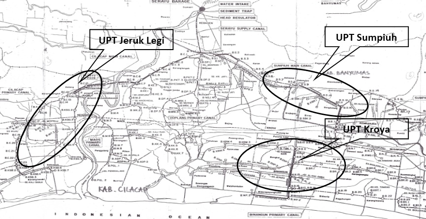 Abstract: Evaluation performance instruments for irrigation systems quantitatively developed using system approaches based on its outputs had been applied in the irrigation system regions of Serayu river, central Java. System outputs which had been used as main indicator reflected the levels of sufficiency and appropriate water supply, irrigation efficiency, condition and function of drainage systems, planting area and productivity. Components of irrigation systems in forms of inputs, processes, impacts, and sustainability of irrigation systems were considered into auxiliary indicators. Observed samples which each represented upstream, middle, and downstream zones, were UPT Jeruk Legi, UPT Kroya and UPT Sumpiuh. Using score from 1 to 4 the result of performance evaluation of irrigation systems were good: the irrigation systems at the upstream, the middle and the downstream had a total score of 2.87, 2.20, and 2.13, respectively. Based on the irrigation outputs using evaluation components used as basis in evaluating operation and maintaining performance (O&P) indicated that O&P performance of the upstream, the middle, and the downstream zones were categorized very good, good and good at a score of 3.05, 2.50, and 2.42, respectively. By positioning the irrigation systems in forms of quadrants, UPT Jeruk Legi and Kroya were laid in the quadrant 1 which indicated the performance criteria of irrigation systems was sufficiently fulfilled to produce the desired irrigation output. While, UPT Sumpiuh was in the quadrant II, indicating the respective criteria still required improvement to gain the desired output.
Keywords: Irrigation system performance evaluation, O&P irrigation systems, main and auxiliary indicators
ABSTRAK: Instrumen evaluasi kinerja sistem irigasi secara kuantitatif dikembangkan dengan pendekatan sistem dan berbasis keluaran telah diaplikasikan di wilayah sistem Irigasi Serayu, Jawa Tengah. Keluaran sistem dipakai sebagai indikator utama (main indikator) mencerminkan tingkat kecukupan dan ketepatan pemberian air, efisiensi irigasi, kondisi dan fungsi sistem drainase, luas tanam dan produktivitas. Komponen sistem irigasi dalam bentuk input, proses, dampak dan keberlanjutan sistem irigasi dimasukkan sebagai indikator tambahan (auxiliary indicator). UPT Jeruk Legi, UPT Kroya dan UPT Sumpiuh dipakai sebagai daerah irigasi sampel yang masing-masing mewakili daerah atas, tengah dan bawah.
Dengan menggunakan rentang skor 1-4, hasil penilaian kinerja sistem irigasi berada dalam posisi baik. Daerah irigasi yang berada di daerah atas dan tengah mempunyai total skor 2,87 dan 2,20 dan daerah bawah mempunyai total skor 2,13. Berbasis pada luaran, komponen evaluasi dipakai sebagai dasar dalam menilai kinerja Operasi dan Pemelihataan (O&P). Hasilnya menunjukkan bahwa kinerja O&P daerah irigasi bagian atas termasuk kategori sangat baik (skor 3,05) dan bagian tengah dan bawah termasuk kategori baik (skor 2,50 dan 2,42). Dengan menempatkan posisi kinerja sistem Irigasi dalam bentuk kuadranisasi menunjukan untuk UPT Jeruk Legi dan Kroya berada pada kuadran I yang mengindikasikan prasyarat kinerja sistem irigasi terpenuhi untuk menghasilkan keluaran yang diinginkan, sedangkan untuk UPT Sumpiuh berada pada kuadran II yang berarti prasyarat kinerja sistem irigasi masih memerlukan peningkatan untuk memenuhi keluaran yang diinginkan.
Kata Kunci: Evaluasi kinerja sistem irigasi, O&P sistem irigasi, indikator dasar, indikator tambahan
Download for the full article here
]]>
Wadaslintang Reservoir
Wadaslintang reservoir is located in the District of Purworejo Central Java Province Indonesia with cathment area is 192.58 km2. Its was built in 1989 with a capacity of 443 million m3 and provide waters for various needs such as irrigation, fishery, electric power, industry, household consumption and others. The current condition at the upstream area of the reservoir indicate a change in water availability.
Water availability is amount of rainfall that arrested in a watershed and transformed became runoff for a period. In water resources management, Its very important to know the water availability as a base to arrange the regulation related to water use for various needs. Study on monitoring and evaluation of watershed condition in 2010 by Serayu Opak Office, Ministry of Public Works shows the upstream watershed of the reservoir is in good condition, but the ratio of annual water yield and the reservoir capacity is 0.4, Its mean that there is a discrepancy between plan and actual water yield.
At the same year in 2010, also implemented the research on Quantitative Evaluation Model of Irrigation Performance at Wadaslintang Irrigation System downstream of Wadaslintang Reservoir by Serayu Opak Office and the result show that the irrigation performance is not good in water service, especially in dry season. To solve this problem, need to arrange a good water resources management by considering the water availability.
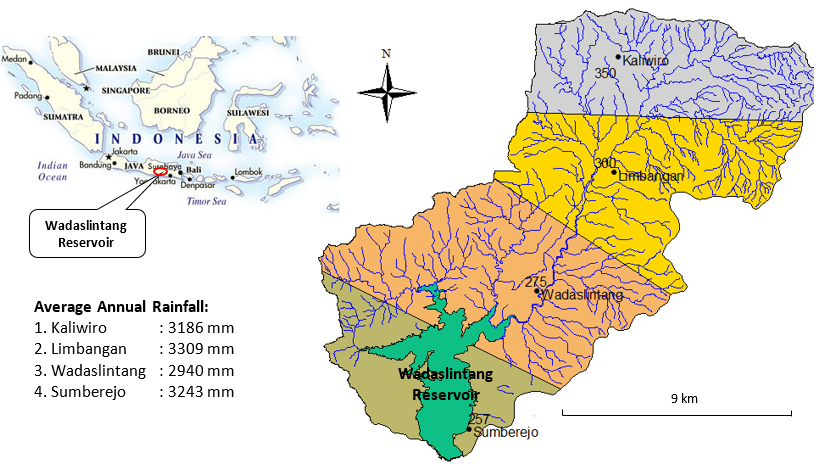
Map of Wadaslintang Reservoir Cathment Area
Rainfall data was used as input to measure water availability. The data collected from four rain gauges in Kaliwiro (in altitude 350 m msl), Limbangan (in altitude 350 m ms), Wadaslintang (in altitude 275 m msl) and Sumberejo (in altitude 257 m msl). Rainfall zonation divide upstream area of the reservoir became four part based on number and position of the rain gauges (see figure below). Each part of has the meaning that the value of rainfall in that area is same and water availability will be analized in each area using hydrologic analysis. The largest area of rainfall zone is Wadaslintang with area 63.44 km2, Limbangan with area 51.14 km2, Kaliwiro with area 43.73 km2 and Sumberejo with area 34.21 km2. Number of the rain gauges in this area is in good category. WMO recommend one raingauge for every area 600-900 km2 in tropical region.
The annual rainfall in the upstream of Wadaslintang Reservoir is high enough and includes category of tropical regions where rainfall reaches 3000 mm/year (> 700 mm/year). Temperature is between 220C-26.30C and land slope dominated by area between 0-15% with the highest slope area located in east side. Type soil in the watershed dominated by latosol and podzolic soils. Soil type are very conducive to agricultural activities, so that in the upstream of the reservoir is growing number of agricultural areas conducted by the local community.
The total annual water discharge of Wasalintang reservoir is 353.31 million m3, where the highest water discharge was from Limbangan around of 103.39 million m3, and then Wadaslintang was 102.69 million m3, Kaliwiro was 81.32 million m3 and Sumberejo was 65.91 million m3. Figure below shows water availability at Wadaslintang Reservoir.

Water Availability of Wadaslintang Reservoir
There are two monsoon in Indonesia, dry season (from April to September) and wet season (October to March). Water availability patterns following the monsoon where the waters is available in huge number at wet season and decrease at dry season.
ACKNOWLEDGEMENT
This article is part of research in the year of 2009 under guidance of Prof. Sahid Susanto, Faculty of Agricultural Technology UGM and funding by Main Office of Serayu-Opak River Basin Development (BBWS.SO), Yogyakarta. For that reason, our thank is addressed.

Merdada Lake
Merdada Lake is situated in the area of Dieng plateau which is administratively located in Karang Tengah village, Batur district, Banjarnegara regency, Central Java province. The lake covers around 75 ha of catchment area and 22 ha of inundated area to accommodate 518,520 m³ of water. This lake played an important role as water resource used for agriculture activities around the lake as well as to support the ecology and ecosystem of the area. Even though the catchment area is relatively small, the lake has never run out of water despite its continuous use for irrigation of wide horticulture activities, especially the potato farms.
The lake is mostly used for farm irrigation while partly is still in the forms of forest and bushes. The farm covers 44 ha of land, while the rest 11 ha is still forest and bushes. Because of its significant potential and role of the water resources in the community’s economy, the government should pay attention to the lake.

Stoning the Terrace
In 2010, a collaborative program was conducted by the Office of Serayu-Opak River Basin Development (BBWS.SO) and Center of Agro-ecology UGM by building water tower, stoning the terrace, and planting the conservation plants. The water tower was built to reduce the cost of water for irrigation, while the stoning and planting activities aimed to reduce the land erosion and sedimentation as well as to protect the water by optimizing the infiltration and reducing the surface runoff. The program involved the farmers around the lake who acted to be the executors. Prior to the program, dissemination was conducted to get input from the community so that the program meets what they needed.

Water Tower and Irrigation Pipe
In this integrated conservation program, the improvement was also applied to the drainage channel and the drop structure. A good quality drainage system was able to reduce the land erosion and optimize the land utility as well as reduce the unused water. The improvement of the drop structure aimed to optimize the drop structure and to reduce the impact of energy resulted by the water current which was potential for causing erosion.
According to the plan, the tower functioning as water container was placed in the highest point in the area. The utility of tower instead of water container allowed easier provision and relocation to the ideal spot. The two water towers with capacity of 1500 liter (total 3000 liter) were connected to one pipe lining to the pump and several output pipes for water distribution to the land.

Greening of Merdada Lake
The improvement and strengthening of the terrace were conducted by improving its physical structure and placing stones to strengthen the front part of the terrace. The same rules were applied also in the improvement and strengthening of drainage channel and drop structure. The terrace was planned to be 1 meter tall, but in the execution it was adjusted to the condition due to the various horizontal condition of the interval. The conservation plants were planted in the area of 2-3 ha at the edge part of the farm land with 6 meter interval as planned. The conservation plants were expected to be able to improve the covering ability of permanent vegetations onto the land and the water.
ACKNOWLEDGEMENT
This program could not be realized without financial support from Main Office of Serayu-Opak River Basin Development (BBWS.SO), Yogyakarta. For that reason, our thank is addressed. Our thank is also addressed to our team: Prof. Sahid Susanto (team leader), Ir. Sukirno MS., Prof. Sigit Supadmo Arief, Prof. Moch. Maksum from Faculty of Agricultural Technology UGM and Ir. Adjat Sudrajat MT., from BBWS.SO, Yogyakarta for their contribution in the program.

Map of Upstream of Serayu Watershed
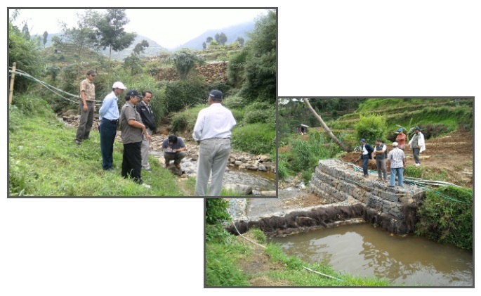
The upstream area of the Serayu watershed situated around the Dieng Plateau was in danger of degradation due to the land over-exploitation for agriculture. The uneven land topography with steep slopes increased the potential damage of the watershed. In addition, the watershed sedimentation level was also high due to the erosion and landslide along the river line. Dealing with this situation, the Directory of Water Resources of the Minsitry of Public Works via the Office of Serayu-Opak River Basin Development (BBWS.SO) in collaboration with the Department of Agricultural Engineering, the Faculty of Agricultural Engineering Technology UGM, designed an integrated conservation program. The program was conducted by constructing buildings to control the sediment, gully plug; planting conservation plants and strengthening of river channel; and repairing the water facilities and infrastructure. The program used demonstration plots by involving the local community. The program took place in Patak Banteng Village, Kejajar District, Wonosobo Regency, which was geographically included in the upstream area of Serayu watershed.

Socialization of the Program
The establishment of the demonstration plots involved the local community through the local government and local groups. The community played the role as the executor, maintainer, and beneficiary of the plots, whether direct or indirect, while the government through the Office of Serayu-Opak River Basin Development (BBWS-SO) acted as the provider of the facilities and materials. Meanwhile, the academic institution (UGM) played the role in giving guidance, supervision, and assistance to the program, as well as conducting dissemination, socio-economic survey, improvement of awareness and the community’s role in the conservation program, design production, and evaluation.
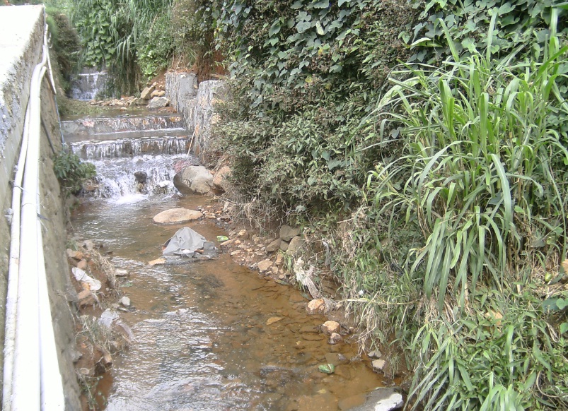
Gully Plug
The gully plug design of stone-pair used the shape of dam consisting of mica floors, crest weir, stilling basin, and wings. The front floor of the dam functioned as protection for the building from the piping effect which might erode the building base. The crest weir was in the shape of ogee equipped with streamline effect which allows water to move following the shape of the crest weir; thus, it would not damage the building as it was elevated in accordance with the desired depth of the tunnel. Meanwhile, the stilling basin was built a bit deeper and functioned as the building foundation. The upstream part was elevated to be equal with the tunnel base to avoid erosion caused by the water. The wing parts were built to direct the water and prevent it from flowing to the sides of the building.

Sediment Control Building in Shape of Gabions Construction
The Sediment Control Building (BPS) was in the shape of gabions construction, equipped with fibers of palm tree in the front part of the crest weir. The building was designed in such a way that it looked like a dam consisting of crest weir, stilling basin, and gabion construction wings. The crest weir part was equipped with fibers of palm tree to elevate the water surface to be as high as the crest weir, so the farmers could easily access the water. For the sake of security, the upstream part was given a pile of gabions to avoid erosion caused by the water. The gabions construction wings in the upstream and downstream parts were made to be leaning horizontally to direct the water not to flow through the sides of the The gabions construction as it might endanger the building stability. The pile of the The gabions construction was built alternately to create strong bound.
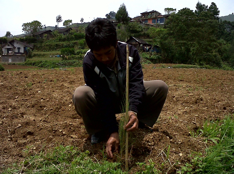
Planting of Conservation Plant
The conservation plant, pines—as chosen by the community, were placed along the watershed in the BPS location, Gully Plug, and the springs.
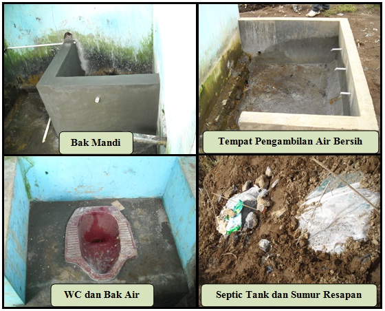
Improvement of Sanitation Facilities
The improvement of sanitation facilities included the building of clean water resources, bath container, squat closet, clean and dirty water pipes, septic tank, and absorption well. The establishment of demonstration plot for water resources conservation in general received positive responses from the community. For example, the water in the gully plug was used by the community to irrigate the potato farms. In addition, the sanitation facilities and access to clean water were also directly used by the community.
ACKNOWLEDGEMENT
This program could not be realized without financial support from Main Office of Serayu-Opak River Basin Development (BBWS.SO), Yogyakarta. For that reason, our thank is addressed. Our thank is also addressed to our team: Prof. Sahid Susanto (team leader), Ir. Sukirno MS., Prof. Sigit Supadmo Arief, Prof. Moch. Maksum from Faculty of Agricultural Technology UGM and Ir. Sigid Santoso MM., from BBWS.SO, Yogyakarta for their contribution in the program.
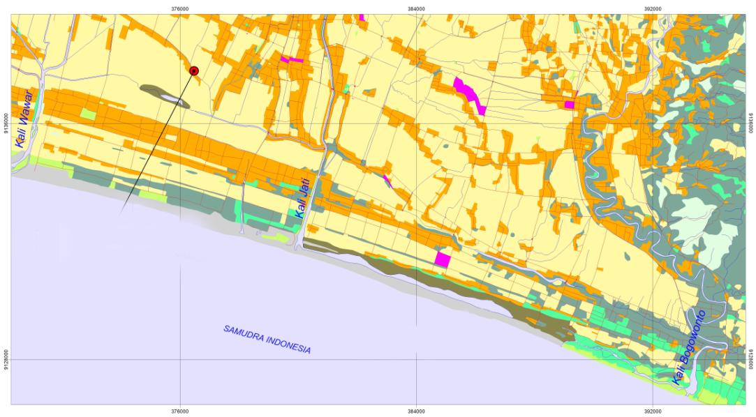
Map of Jati River
The Serayu-Opak watershed consists of several rivers heading to the Hindia Ocean, namely Jali River and Bogowonto River. In general, the rivers have several sub-rivers in both the upstream and downstream. The ones in the upstream, such as Lereng River and Jati or sand which connect Mawar River, Jali River, and Bogowonto River, are characterized by their shallow wall making them vulnerable to flood. The rivers lie along the coastal line and are situated nearby the beach with their estuaries adjacent to those of Bogowonto River and Jali River
The flow of Lereng River and Jati or Pasir River is really determined by the condition of Bogowonto River and Jali River, especially when the flood occurs or the estuaries of the two rivers are closed. Jati River and Pasir River flow throughout the coastal sand field and in the surrounding areas there are permanent and temporary water pond which have not been optimally used. The potential area covers approximately 0.5 km x 14 km or 7 km2, which is equal to 700 ha, consisting of rain farm field and inundated land. The land potential for fisheries development includes the permanent inundated land covering 0.2 km x 14 km or 2.8 km2 or 280 ha.
In the period of 2008-2009 a freshwater fisheries farming was tested in the areas of Jati River swamp located in two locations: Dudu Kulon Village and Giri Rejo Village. The program was collaboratively conducted by the Department of Agricultural Engineering UGM and the Office of Serayu-Opak River Basin Development (BBWS-SO) involving the farmer group of “Mina Raharja” in Girirejo Village and the group of brackish water fisheries farmer “Lestari” in Dudu Kulon.

Provision of Fish Seed
The demonstration plots are located in Girirejo and Dudukulon Village covering 4,500 m2 for each, cultivating karper, red nila, and gift nila with the breeding size of 5 cm-7 cm. The breeds consisted of 2,000 karpers, 4,000 red nilas, and 5,000 gift nilas. The breeds were spread on 25 July 2009 and were harvested on 1 and 5 October 2009 resulting in karper 400 kg of karper, 300 kg of red nila, and 600 kg of gift nila. The ponds in Girirejo Village used natural feed (algae, wide-leaved, freshwater shrimp, and 60 kg of pellet) which were abundant around the village. After three months, the fish were ready to harvest as the fish rapidly grew due to the abundant stock of feed.

Fish Harvesting
The followings are some of the required technological inputs:
- Build sluice gate to control the water and drainage for land based on hydrological analysis of the Bonorowo south coastal areas.
- Conducting analysis of land suitability and agricultural land grouping based on hydrological characteristics of the area and the soil type.
- Determining the non-pond planting pattern.
- Conducting coordination on inter-institutional activities among the departments in Purworejo Regency.
- Building road infrastructure facilities in the target location from the village entrance gate heading to the main location
ACKNOWLEDGEMENT
This program could not be realized without financial support from Main Office of Serayu-Opak River Basin Development (BBWS.SO), Yogyakarta. For that reason, our thank is addressed. Our thank is also addressed to our team: Prof. Sahid Susanto (team leader), Ir. Sukirno MS., Prof. Sigit Supadmo Arief, Prof. Moch. Maksum from Faculty of Agricultural Technology UGM and Ir. Sigid Santoso MM., from BBWS.SO, Yogyakarta for their contribution in the program.
Text in Indonesian