Advertise with Googlier.com Chattooga Conservancy https://chattoogariver.org Working to protect, promote and restore the natural ecological integrity of the Chattooga River watershed ecosystems; to ensure the viability of native species in harmony with the need for a healthy human environment; and to educate and empower communities to practice good stewardship on public and private lands. Mon, 26 Oct 2026 15:43:39 +0000 en-US hourly 1 https://wordpress.org/?v=7.1.3 https://chattoogariver.org/wp-content/uploads/2017/02/footer_logo_icononly.png Chattooga Conservancy https://chattoogariver.org 32 32 Long-distance footraces seek permits in Wild & Scenic Corridor – Comments Due Oct. 19 https://chattoogariver.org/long-distance-race-permits/ Fri, 02 Oct 2026 19:10:41 +0000 https://chattoogariver.org/?p=46005

The U.S. Forest Service (USFS) sought public input through October 19, 2026, on new proposed permits for commercial use of national forest land in the Chattooga River watershed. The proposal would allow two competitive, long-distance footrace events to take place on public national forest land in and around the Chattooga River watershed in SC, GA, and NC.

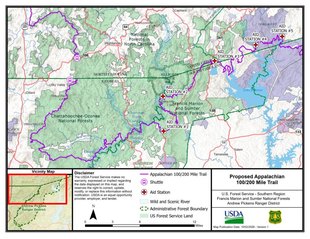
In a letter announcing the proposed permits, USFS did not disclose the names of the organizations, intended routes, or proposed event schedules, but did state that the race courses would enter the Wild & Scenic Chattooga River corridor. Chattooga Conservancy has since obtained further details from USFS, as follows:

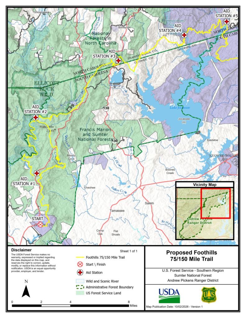
The proposal would issue one-time permits to two separate commercial events, organized by Run Bum Tours and Warrior Races, respectively.

  • Run Bum Tours race proposed for March 10–14, 2027. (See below for USFS agency-specific map of the course through public land.)
  • Warrior Races event proposed for April 9–11, 2027. (See below for USFS agency-specific map of the course through public land.)

If authorized, USFS intends to use these events to evaluate “whether similar events may be permitted in the future.”

Chattooga Conservancy’s concerns include:

  • Expanded commercial use of the Wild & Scenic Chattooga River corridor. USFS uses “established use,” or commercial uses that have previously occurred, to assess and authorize future permits. But this only works in one direction. Once use is established, it is hard to walk back.
  • Potential resource damage. The events would concentrate more human activity along the proposed racecourse than typically occurs within a three-day period for many stretches in the Chattooga River watershed. Sensitive areas, like riparian zones and tributary creek crossings/fords might experience negative impacts from higher-volume use.
  • Potential conflicts with special management areas. Both proposed racecourses run along the boundary of and may enter the Ellicott Rock Wilderness. Commercial races are not allowed in Wilderness or Wilderness Study Areas. Both proposed racecourses enter the Ellicott Rock Extension Recommended Wilderness Area (aka Ellicott Rock 2 Roadless Area). According to the Sumter Forest Plan, “commercial and organized group size is limited to 12” in the Ellicott Rock Extension. Both proposed racecourses use the Chattooga River Trail through a wild-designated segment of the Chattooga Wild & Scenic Corridor. Management of wild segments “is focused on protecting the outstandingly remarkable values of the river and preserving the natural environment and natural processes from human influences.”

Public input was accepted on the proposed permits through October 19th, 2026. Read the full USFS letter HERE.

Documents: 

Chattooga Conservancy Comments_Long-distance_trail_event_feedback
Run Bum Tours race, USFS map:

Warrior Races race, USFS map:

]]>
Species Spotlight: September Wildflowers https://chattoogariver.org/species-spotlight-sept-wildflowers/ Tue, 29 Sep 2026 15:10:33 +0000 https://chattoogariver.org/?p=46066
September on the Chattooga: a time for reflection and anticipation.

Summer heat lingers long, as midday temperatures maintain their sultry summits, but mornings begin to grow cooler. Swimming holes are still sought for rejuvenating afternoon dips, while an extra blanket is added to the foot of the bed in anticipation of brisk evenings. Birds travel south, feeding frantically to energize for their arduous journeys. Trees reveal their dramatic side, boldly proclaiming fall’s arrival through pigments of radical red and yellow. Acorns fall, bears fatten, and daylight fades; these are the signs that summer is relinquishing its residency in the mountains, and fall is beginning to unpack its bags. While it never stays as long as we would like, its visit is action packed and reinvigorating. As new colors permeate the landscape and animals finalize their winter preparations, it can be hard to know where to direct your attention. No matter where you look, however, fall’s wildflowers are hard to ignore.

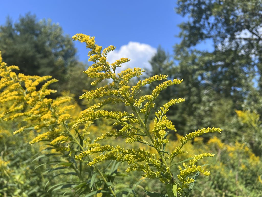
Goldenrod (Solidago spp.)

Widespread and vibrantly visible, Goldenrod is a fall classic. Blooming from late July through early November, this wildflower stands out in any unmowed pasture or disturbed section of streambank. Reaching between 4–8 feet in height, Goldenrod flowers a vigorous yellow. In 2003, South Carolina changed its state wildflower to Tall Goldenrod (Solidago altissima), and for good reason. In addition to its beauty, Goldenrod is a powerhouse wildlife plant. Across its range in the eastern United States, it is used by 104 caterpillar species as a food source and larva host.

Through the winter, songbirds eat seedpods from the standing dead stalks. As many as 42 species of bee rely specifically upon goldenrod as their pollen source. Goldenrod’s pollen is sticky and heavy, holding firm to the flower, so the plant depends upon insects for pollination instead of dispersion by wind. While Goldenrod is often blamed for causing seasonal allergies, it is actually ragweed pollen that is responsible for fall coughs and sneezes. Goldenrod’s genus name, Solidago, is derived from the Latin words “solidus” and “ago” put together, meaning “to make whole.” Goldenrod species have been used in traditional medicine worldwide for hundreds of years.

Roadside Goldenrod (Solidago spp.) in the Chattooga watershed. Also used as header image. Credit: Chattooga Conservancy
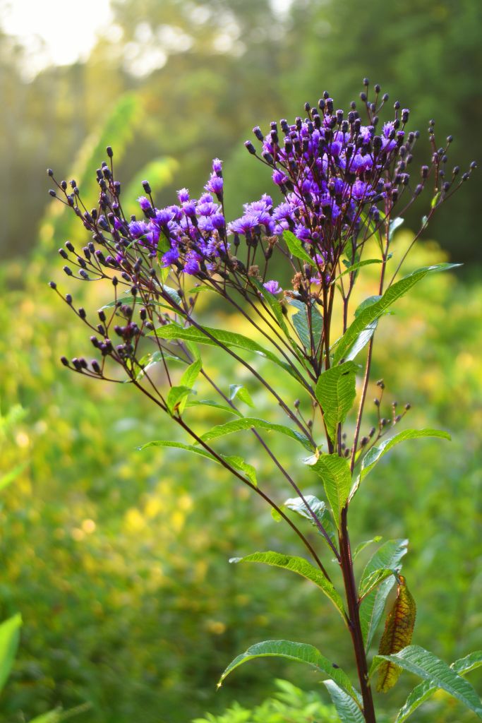
Tall Ironweed (Vernonia gigantea), by NPS/Rick Santich, via NP Gallery (public domain).
Ironweed (Vernonia spp.)

On most any rural backroad through pastureland resides a tall and sturdy wildflower known as Ironweed. Characterized by rich, deep purple flowers atop a tall stem, Ironweed ranges from 5–10 feet in height and can be found in low-lying seeps and creeks where sunlight is abundant. Its name comes from its solid stem and rust-colored seed pods. Like Goldenrod, Ironweed is a standout late-season pollinator. Its presence in the landscape is ensured due to bitter-tasting leaves and stems, which dissuade deer and cows from eating it. Several parts of the Ironweed plant can be used in natural dye processes. The flower yields a range of pink and purple tones, and the stem and leaves produce varying shades of green.

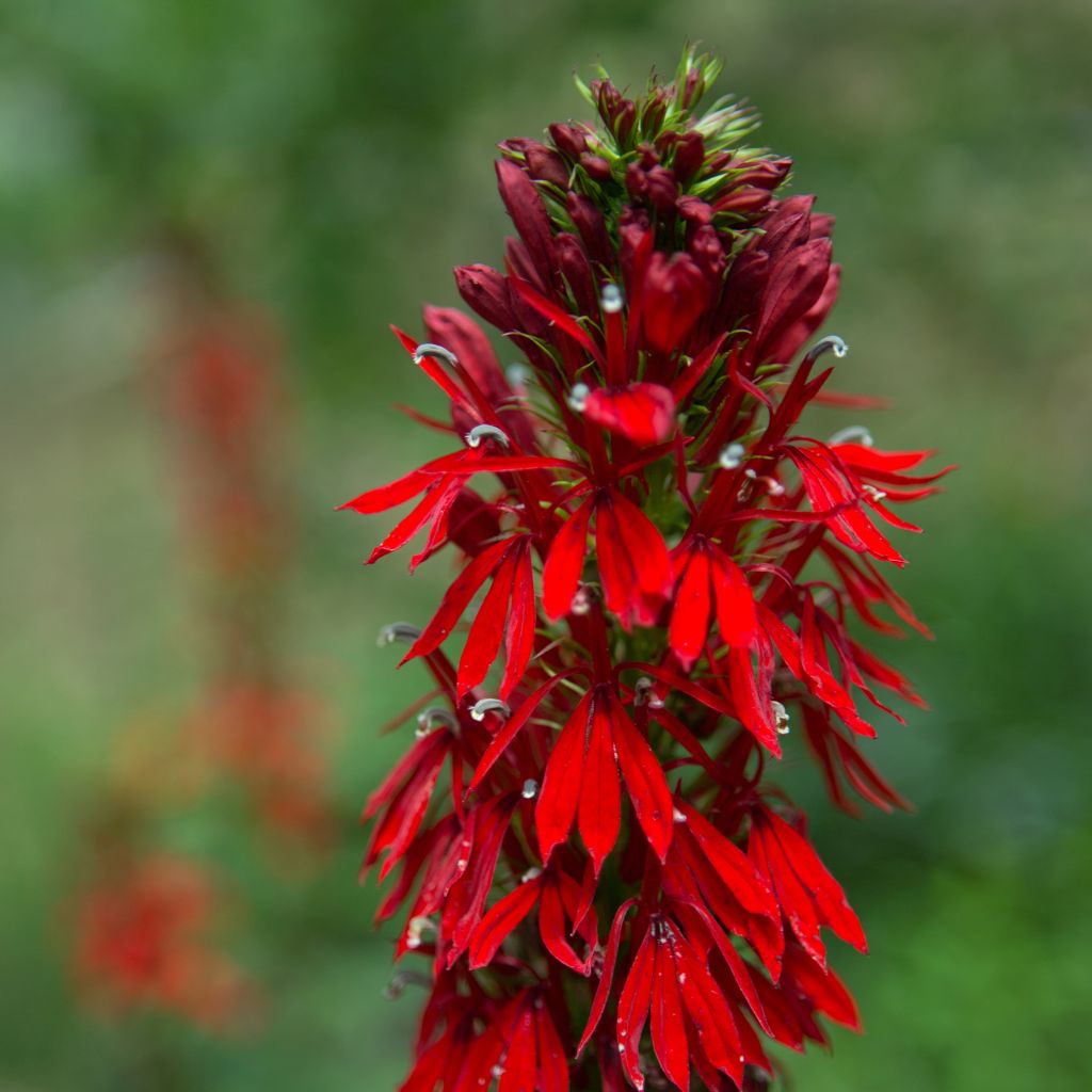
Cardinal Flower (Lobelia cardinalis)

It’s hard to miss a Cardinal Flower. Growing in low-lying wetlands, this fall gem can grow up to 4–5 feet tall and undoubtedly sports the season’s most brilliant scarlet-red flower. It is most often seen near water, along pond and stream banks, as well as in wetlands and drainages. It has long, tube-shaped flowers that make accessing pollen difficult for insects. Therefore, the Cardinal Flower relies on hummingbirds for pollination. Cardinal Flower is a member of the Lobelia genus. Known for containing alkaloids, this plant is toxic if improperly consumed.

Cardinal Flower. Credit: Peter McIntosh.
]]>
Travel Management Rule Revision https://chattoogariver.org/travel-management-rule-revision/ Mon, 28 Sep 2026 15:23:44 +0000 https://chattoogariver.org/?p=46082
The U.S. Forest Service has taken yet another step in its systematic dismantling of national environmental regulations.

This time, the agency is taking aim at the Travel Management Rule, longstanding USFS policy on motorized vehicle use on national forest lands.

Instituted in 2005, the Travel Management Rule balances recreational uses and ecological values, providing a framework for forest managers to designate where motor vehicle access is allowed. The rule can be generalized to a default status of “closed to motorized use unless specifically designated open.” Other major elements and key terminology include:

  • Clear designations: Motor Vehicle Use Maps (MVUMs) – Every national forest must have a designated transportation system that specifies where and how ATVs, dirt bikes, 4WD vehicles, snowmobiles, and cars can be driven, and must publish a Motor Vehicle Use Map to show these routes.
  • “Minimization criteria” – New or modified motorized access must minimize damage to natural resources, harassment of wildlife, and potential conflicts with other recreational uses.
  • Travel management planning process – The public is allowed to participate in reviewing changes to travel management at the local or district level.

Now, USFS is proposing to fundamentally alter the way motorized use is managed, by gutting the Travel Management Rule. In a Notice of Intent to revise the Rule, published August 24, 2026, the agency announced its plan to switch to an “open unless designated closed” default. Other changes would eliminate the minimization criteria, reduce public review opportunities in travel management planning, and “establish a requirement to consider new roads, trails, airfields, trailheads, and other access routes and points where appropriate to increase access.”

The proposed changes have drawn criticism from a broad coalition of interest groups. American Trails, which represents recreational trail users including hikers, bikers, horseback riders, and motorized users, expressed concerns that an “open unless designated closed” default could create confusion, conflicts, and safety hazards for trail users of all types. These concerns are echoed by other recreation and conservation groups, like Outdoor Alliance and The Wilderness Society, who likewise point to potential resource impacts including exacerbated landscape fragmentation, and damage to sensitive areas and wildlife.

The proposed overhaul would strain not only natural but financial resources. USFS already faces a $9 billion road maintenance backlog, a $300 million trail maintenance backlog, and a $229 million recreation backlog. A blanket expansion of motorized use would create even more maintenance demands that the agency is clearly not equipped to meet. On the ground, this could lead to unsafe trail conditions, as well as increased erosion and water pollution from trails not designed or modified to accommodate motorized use.

Timeline:

The August 24th Notice of Intent is the first step in the process to overhaul the current Travel Management Rule framework. (For context, this is approximately where the Roadless Rule repeal process was about one year ago. Both of these environmentally damaging proposals were initiated in response to Executive Orders from President Trump.) USFS is expected to publish the full text of the proposed rule change in the spring of 2027.

Action steps:

Chattooga Conservancy has joined a coalition of 128 conservation organizations in sign-on comments about the proposed Travel Management Rule change.  There will be another chance to comment once the actual proposed rule change and environmental impact statement are published next year. We will let you know when this occurs! For now, it is worth considering the combined impacts of the Travel Management Rule changes and Roadless Rule repeal when you write your Roadless Rule comments.

Image: Gravel road, on the way to the river in fall. Credit: David Sibilio.

]]>
Thanks for Joining Us at Stay Wild! https://chattoogariver.org/stay-wild-2026-recap/ Sun, 27 Sep 2026 16:04:50 +0000 https://chattoogariver.org/?p=46103
Thanks to you—Stay Wild 2026 was a success!

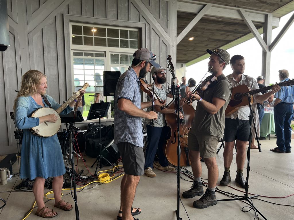
On July 25th, over 300 supporters joined us to celebrate our community and the Chattooga River at Chattooga Belle Farm in Long Creek, SC. The stormy weather cleared up just in time for everyone to enjoy the stunning grounds and views while music by Steady Hand String Band and Prince Toad drifted through the valley.

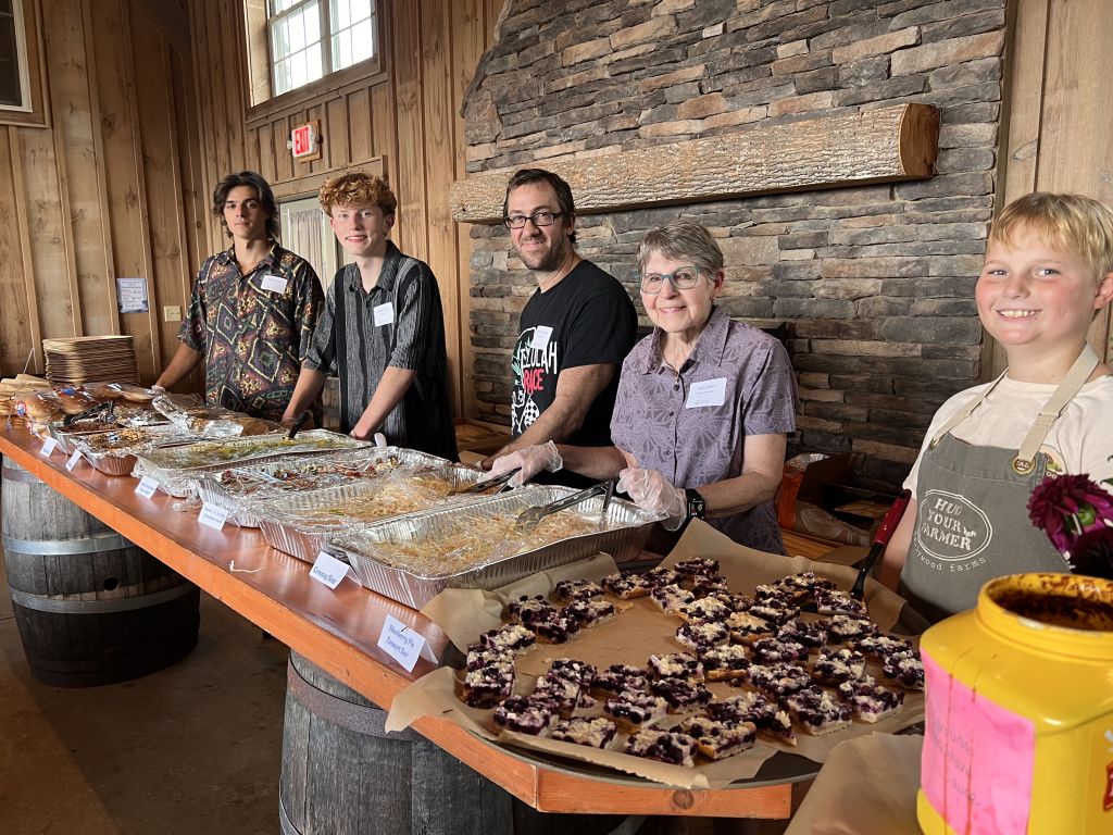
We thoroughly enjoyed Chef Amanda Callahan’s farm-to-table dinner and dessert along with drinks provided by Reid Farmstead, Carolina Bauernhaus, Jocassee Valley Brewing Company, Golden Grove Farm & Brew, and Appellation Wine. With 59 silent auction items, 20 raffle items, and plenty of t-shirt and sticker options, there were so many opportunities to support protecting the beautiful Chattooga River and its watershed. We hope everyone ended up with something good!

We want to say THANK YOU to the individuals who stepped up to financially sponsor the event, the many businesses who donated items and supplies, the volunteers who gave their time, and everyone who joined us for an amazing evening in joyful community. It truly takes a village, and we are so grateful for your support. To see a full listing of the awesome businesses and individuals who made this event happen, check out our event website page.

We’ll do this again, but until then—Stay Wild!
Image credits: header image courtesy of Stu May; other images courtesy of Casey Certain.
]]>
Outdoor Classroom: Field Visits With Students from Highlands Biological Station https://chattoogariver.org/hbs-field-trips-2026/ Sun, 27 Sep 2026 15:29:25 +0000 https://chattoogariver.org/?p=46085
Over the past couple of months, Chattooga Conservancy staff had the privilege of joining two different field days with students from the Highlands Biological Station. Read our event summaries below. Thank you to everyone who participated!

Conservation Biology Class Field Day

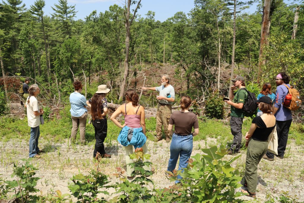
On July 28th, Southern Environmental Law Center (SELC) attorneys joined Chattooga Conservancy staff for a field day and classroom session with the Highlands Biological Station’s summer Conservation Biology course. The focus was on management of our national forests, both locally and through current executive orders and federal policies. We led the group to view a logged forest stand in the sensitive Slick Rock area off the Bull Pen Road (NC), which was cut as part of the controversial Southside Project in the Nantahala Ranger District.  While viewing the aftermath of the logging, we discussed our observations compared to the Forest Service’s stated goals as approved in their paperwork. All agreed that the sparse, damaged, and predominantly maple and locust “leave trees” and other visible negative impacts were far from the Forest Service’s “desired future conditions” and illustrated the harsh impacts of the heavy-handed logging pushed through by the Southside Project.For comparison, we also visited an old-growth forest accessed by the Ellicott Rock trail from the Ammons Branch campground (NC). The rich, multilayered, and biologically diverse native forest displayed a bounty of thriving species and habitats characteristic of the temperate rainforest of the Chattooga headwaters.Following the field trip, SELC attorneys led a classroom session and laid out the challenging landscape presented by the current, full-scale attack on federal laws and policies that formerly safeguarded our environment. Topics discussed included radical changes to the National Environmental Policy Act, the bedrock foundation of many environmental protection provisions (including citizens’ right to know and comment), and the current proposal to rescind the Roadless Rule, etc.  It was both a sobering discussion and an uplifting call to action, particularly as voiced by many students in the Conservation Biology class. We appreciated the opportunity to participate with partners at SELC in the Highlands Biological Station’s programs, to help support their mission to foster research, education, and conservation focused on the rich natural heritage of the southern Blue Ridge, a global biodiversity hotspot.

Image header: HBS Associate Director Jason Love and Chattooga Conservancy Executive Director Nicole Hayler speak to UNC-CH students beside the Chattooga River, on a microplastics sampling field visit to Raven’s Rock. Credit: Chattooga Conservancy

Microplastics Field Visit

On September 14th, Chattooga Conservancy staff had the opportunity to accompany Jason Love, Associate Director of the Highlands Biological Station, and his students to Raven’s Rock on Section IV of the Chattooga, where they collected samples for ongoing research on microplastic pollution in the Southern Appalachians. This research is being conducted by Love and his colleague Dr. Rada Petric, Director of the Highlands IE program with UNC Chapel Hill.

The trip was a part of the Highlands Field Site, a program offered by UNC Chapel Hill that gets undergraduate students out into the field for real, hands-on research with Highlands Biological Station staff. Their research—which focuses on sampling for microplastics in Appalachian watersheds by harvesting and testing invasive Asian Clams (Corbicula fluminea)—is a clear favorite among the students, who spent the day snorkeling for clams and swimming below Raven’s Rock.

Over a picnic lunch, Chattooga Conservancy Executive Director Nicole Hayler gave a talk on the natural and conservation history of the Chattooga River watershed and our organization’s work to protect it.

The students harvested more than ten clams, which were kept on ice to be brought back to the lab, where their contents will be dissolved, plated, and examined through a dissecting microscope for ultra-tiny plastic fibers, the most common form of microplastics in our rivers.

That’s because, unlike microplastic beads, shards, and “nurdles,” fibers tend to have a certain loft to them—they can be easily swept up into the atmosphere, where they get pushed around by storm systems and ultimately deposited into rivers and streams via rainfall. That means even the wildest and most pristine areas—areas like the National Wild & Scenic Chattooga River—can still be impacted by microplastic pollution.

Discussing timber harvest impacts from the Southside Project observed in the Slick Rock area (Nantahala National Forest) with the Conservation Biology Class. Credit: Jasmine Williams

Researchers like Jason Love, Dr. Petric, and the Highlands Field Site students are key to understanding the vastly complex challenges of human impacts on the earth, and we’re always happy to collaborate in the important work of the scientists and staff of the Highlands Biological Station. Chattooga Conservancy wishes the students a rigorous and rewarding rest of the semester at the Highlands Field Site!

]]>
Postcards for Public Lands Events https://chattoogariver.org/2026-postcards-public-lands/ Sat, 26 Sep 2026 16:19:42 +0000 https://chattoogariver.org/?p=46116
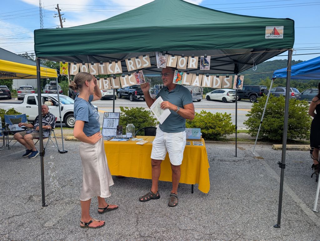
We had four successful Postcards for Public Lands events this month!

Hoping to provide some education on the intended repeal of the Roadless Rule and encourage public comments, we held community postcard writing events. Special thanks to Life in Long Creek & Humble Pie, Oldknow Bev. Co. in Clayton, and the Patagonia – Beltline store in Atlanta for hosting us!

Our community really showed up.

Between the four events, we were able to gather over 200 postcard comments! We will be sending these to the appropriate contact at the USDA ahead of the deadline on October 6th.

If you would like to learn more about the issue or submit a public comment before the deadline, check out our website for more information and a link to the federal comment submission page.

]]>
Roadless Rule Action Alert – Comments Due Oct. 6 https://chattoogariver.org/roadless-rule-action-alert/ Fri, 25 Sep 2026 15:14:50 +0000 https://chattoogariver.org/?p=46079
COMMENTS DUE OCTOBER 6TH, 2026

The deadline is approaching for public comments on the proposal to repeal the Roadless Rule! Comments are due by Tuesday, October 6, 2026.

If you have been following Chattooga Conservancy’s social media or previous issues of Chattooga Currents, you are probably familiar with the popular Roadless Rule, and the impending threat to repeal it. For those new to the issue, or in case you need a refresher, here’s what’s at stake, and what you can do:

What is the Roadless Rule?

The Roadless Rule is a U.S. Forest Service regulation established in 2001 that prohibits road construction, industrial development, and logging in Inventoried Roadless Areas of national forests, while still allowing forest management measures to control or suppress wildfires, insect infestations, tree diseases, and certain human health risks. Initially, the rule covered about 58.5 million acres of national forests across the United States, but it currently applies to about 45 million acres following various state-specific exemptions. Roadless Areas account for 30% of our National Forest System lands.

Now, the U.S. Forest Service is proposing to repeal the Roadless Rule, stripping Roadless protections from 45 million acres of national forest and grassland across the United States.

What would losing the Roadless Rule mean for the Chattooga River watershed?

The Appalachian Mountains hold the vast majority of Inventoried Roadless Areas in the Eastern United States.

There are almost 18,000 acres of Inventoried Roadless Areas within or immediately surrounding the Chattooga River watershed. About 11% of the public land within our watershed is protected by the Roadless Rule.

As you’ve traveled through some of these special places in and around the Chattooga River watershed, such as Rabun Bald, Overflow Creek, Sarah’s Creek, or the Foothills Trail, you may not have known you were in an Inventoried Roadless Area. But you likely experienced the benefits of that protection: intact forest landscapes and a remote quality that is otherwise rare in the Southeast.

There is no better testament to the importance of wild places than the sense of quiet solitude and wonder that these Roadless Areas hold. But they offer so much more than that. Roadless Areas contain many upper Chattooga tributaries, and even buffer a portion of the Chattooga River, helping ensure access to clean, crystal-clear water for tens of thousands of recreationalists every year, from trout fishermen to whitewater rafters.

And they are essential for wildlife: many of our watershed’s most threatened species, including the Northern Long-eared Bat, the Small Whorled Pogonia, and the Smooth Coneflower, call Roadless Areas home. Roadless Areas provide the stretches of uninterrupted habitat which are essential to dynamic and thriving ecosystems.

If we lose our Roadless Areas, we will lose the Chattooga River watershed as we know it.

Taking action:

The Roadless Rule is overwhelmingly popular. When the U.S. Forest Service adopted the Roadless Rule in 2001, more than 1.6 million people commented during the rulemaking process, with 95% supporting strong roadless area protection. At the time, this was the most extensive public participation in the history of federal rule-making. In 2025, when the Administration first published its Notice of Intent to rescind the Roadless Rule, roughly 600,000 comments were made during the initial, 21-day comment period, and over 99% of the public comments opposed rescission.

Now, we have what may be the most important opportunity to speak up for these special places. The public comment period for the rescission of the Roadless Rule is OPEN until October 6th, 2026.

To speak up for the Roadless Rule and all that it protects, you can leave a public comment directly on Regulations.gov HERE. If you would like guidance in writing your comment, a compilation of information about the Roadless Rule and a sample comment are available on our website HERE.

Header image: Glen Falls in the Overflow Roadless Area. Credit: Jasmine Williams

]]>
Meet Our New Staff Member – Ericka Berg https://chattoogariver.org/new-staff-ericka/ Thu, 24 Sep 2026 16:09:18 +0000 https://chattoogariver.org/?p=46109

Ericka grew up in Polk County, North Carolina, where her family has deep roots. She attended Berea College in Kentucky and made her way back to WNC as an AmeriCorps member with Conserving Carolina, a land trust in Hendersonville.

After many years working in local and regional land trusts in positions ranging from volunteer management, education, operations, development, and conservation easement stewardship, Ericka has joined Chattooga Conservancy as the Community Engagement and Operations Director.

In her role, Ericka is utilizing her broad nonprofit background. She is expanding our efforts to engage our community in supporting the mission of the Chattooga Conservancy, managing some of the organization’s administrative functions, stewarding the conservation easements, and assisting the Executive Director in land trust operations and landowner outreach.

Ericka and her husband Jay Guidry live in Mountain Rest, a few miles from the river. In her free time, you can find her somewhere outdoors. She “enjoys being bad at many activities,” including gardening, running, mountain biking, backpacking, hiking, whitewater kayaking (in her ducky), and playing disc golf.

Please join us in welcoming Ericka to the Chattooga Conservancy team!

]]>
White Pine Project – USFS Seeks to Log Additional 550 Acres – Comments Due Sep. 25 https://chattoogariver.org/white-pine-expansion/ Thu, 17 Sep 2026 15:49:39 +0000 https://chattoogariver.org/?p=46097
The U.S. Forest Service (USFS) in SC is proposing to add 518 acres of new logging to their ongoing timber projects in the Chattooga and Chauga River watersheds.

USFS announced the proposal in August 2026 and held a small public meeting on August 25th to discuss the possible additions with interested stakeholders.

The proposal would add 12 forest stands (a total of 518 acres) to the existing White Pine Project, one of several ongoing timber harvest projects in the Andrew Pickens Ranger District (portion of Sumter National Forest in Oconee County, SC). Authorized in 2021, the White Pine Project initially included 1,952 acres of logging, along with prescriptions for herbicide application, prescribed burning, planting, and temporary roadbuilding.

The additional stands proposed for harvest include a tract just upstream of Long Creek Falls, an area at the terminus of Sandy Ford Road in SC, and the area around Grapevine Campground, among others.

A quick refresher on timber projects: USFS “projects” are sets of actions proposed for multiple forest stands across an area. These actions are reviewed and approved in bulk, then enacted bit by bit over time, through separate timber sales. USFS has approved and is now implementing several simultaneous, long-term logging projects in Oconee County, SC. These are, primarily: the White Pine Project (2021); the Loblolly Project (2013)/Loblolly Supplement (2018), and the Forest Health Thinning Project (2025). Although the stated purpose and need for each project may differ, USFS often accomplishes multiple projects together. A single sale to a logging company will often involve stands from more than one project.  Take the timber harvest off of the Woodall Shoals Road, for example: harvest in this area included stands from both the White Pine and Loblolly Projects, grouped together into a single timber sale.

The White Pine Project was authorized with a stated purpose of converting “evenly spaced white pine dominated plantations to more diverse mixed species stands that are ecologically suited to the site.” While this goal sounds positive, Chattooga Conservancy commented and submitted an objection on the original project, with concerns including fragmentation of the forested landscape (especially next to and between old-growth stands); the loss through clearcutting of diverse mixed species that were well underway towards natural regeneration; likelihood of largely replacing one pine plantation with another; potential for soil and water quality degradation; cumulative effects between the White Pine and Loblolly projects occurring in the district at the same time; and failure to adequately consider climate impacts. Many of these objections were not addressed, and they continue to apply both to the already-approved White Pine Project actions and the recent proposed additions.

Of the 1,952 acres approved for timber harvest under the original White Pine Project (2021):

  • about 200 acres of timber harvest have been completed,
  • about 100 acres of timber harvest are in progress, and
  • over 1,650 acres of timber harvest are still upcoming.

The August 2026 proposal seeks to add another 518 acres of logging to the queue.

What can you do?

Submit comments on the proposed White Pine Project additions by Friday, September 25th! The Forest Service indicates they will likely authorize the proposed additions under a Categorical Exclusion, meaning they will not be required to complete an Environmental Assessment or Impact Statement. However, the agency is required to either develop or refine the project through a “collaborative process that includes multiple interested persons representing diverse interests.” So the Andrew Pickens Ranger District has published a Public Engagement Letter seeking input. Chattooga Conservancy will submit organization comments, but you can participate individually, too!

You may respond directly to USFS by emailing SM.FS.r8fmsapcom@usda.gov by September 25. According to USFS instructions, “comments should be specific, within the scope of the proposed action, and include supporting reasons. Please identify the project as ‘AP White Pine Plantation Restoration Project.’”

Remember that comments can actually make a difference! Following feedback from Chattooga Conservancy staff at the August 25 public meeting, it looks like USFS has already redrawn project maps and slightly reduced the total project acreage for the proposed addition to avoid logging in the Cedar Creek Botanical/Zoological Area and in one stand of identified old growth (see the “Old Growth (Carlson Study)” layer under “Forest Age Data” in our Interactive Map). Even small boundary modifications can have outsize impacts in the most sensitive areas of our watersheds. Further, this might be the last chance to submit written comments about the proposed addition.

After the comment window closes, you can still help document before and after impacts of USFS projects in and around the Chattooga River watershed. We welcome your observations and encourage photos! Contact us to report an issue.

Email SM.FS.r8fmsapcom@usda.gov to submit comments on the “AP White Pine Plantation Restoration Project” proposed additions.

Image:  Area along Owl Branch Road, off of Woodall Shoals Road, harvested as part of the ongoing USFS White Pine Project. Credit: Buzz Williams, 2026

]]>
Conservation Easement Protects 12 Acres in Chattooga Headwaters https://chattoogariver.org/easement-whiteside-cove/ Sun, 19 Jul 2026 16:03:41 +0000 https://chattoogariver.org/?p=46144
The Chattooga Conservancy is pleased to announce closing on a conservation easement which will preserve 12 acres of ecologically important land near Cashiers, NC.

The Protected Property is located in Whiteside Cove, one of the areas in the Chattooga headwaters that is experiencing the most intense development pressure. Here, private subdivided lands are intertwined with larger Nantahala National Forest tracts around the iconic Whiteside Mountain, an imposing, 4,930-foot granite monolith that marks the headwaters of the Chattooga River. The recently protected 12-acre tract is southwest of Whiteside Mountain, and the majority of the property is directly within the viewshed of Whiteside Mountain. The view from Whiteside’s summit captures a relatively undeveloped portion of the Chattooga watershed, and the Protected Property’s conservation easement will help ensure that this spectacular vista remains unencumbered by excessive development.

The Protected Property contains a native forest regenerating from previous land uses (such as clearing for agriculture) and contains oak-hickory forest types, as well as white pine dominated stands that are indicative of prior clearings. The Property also includes a segment of a small perennial stream that drains into Norton Mill Creek, which is a tributary to the Chattooga River. The tract’s proximity to national forest land and the Wild & Scenic Chattooga River corridor means it provides important habitat connectivity, a value made crucial by the intense development pressure in the Cashiers area.

The Chattooga Conservancy is a nationally accredited land trust and member of the Land Trust Alliance. This enables us to work with willing landowners to protect land through conservation easements, to protect the ecological, agricultural, and/or historical values of qualified properties in the Southern Appalachian Bioregion.  If you are interested in placing a conservation easement on your land, please contact us for more information!

Image: The Protected Property is in the viewshed of Whiteside Mountain and contains native forest types, providing habitat connectivity with national forest lands in the Chattooga River headwaters. Credit: Adam Kluge

]]>