The post The Mountains in Fall first appeared on North Cascades Institute.
]]>Animals are visible and busy, gathering food and arranging their winter affairs. Pikas reap their last bunches of hay, spreading them to dry at burrow entrances before hauling them into tunnels for winter. Thrushes prowl the undergrowth, dissecting overgrown porcini to get at the grubs inside. Higher in the meadows at the edge of the tree line, chipmunks climb late-season asters to get at seed clusters, bending the plants to the ground with their weight. Marmots survey their territory from dignified perches atop boulders littering the hillside.
On the slopes of Mount Rainier, autumn ripens like a bruise, blooming in bilberry’s crimson leaves and powdery cobalt fruit, bog gentian’s ultramarine paper lanterns, and the violet swaths of half-withered purple asters. The trickster mountain peeks out of fogbanks, showing a tantalizing glacier above the trees before vanishing in a whirl of mist. Tendrils of fog descend into the forest, turning rows of silver firs into silhouettes. Dimension and scale fall away in the haze, turning the world into a blur of color. As evening falls, that color fades to a gray scale before extinguishing to near-black twilight.

Sitka Mountain Ash | Sorbus sitchensis
White flowering shrubs proliferate along the high hillsides during summer, from buckbrush to saskatoon to elderberry to oceanspray. I have a bad habit of lumping the visual pattern of these shrubs together, letting them fade into the background of my consciousness in favor of showier species.
When autumn comes, however, these plants diverge into a hundred different presentations of leaf and berry and lift the veil from my perception. This is especially the case with Sitka mountain ash, a shrub that paints the landscape with autumnal color.
The symmetrical pinnate leaves of Sitka mountain ash begin to turn a syrupy golden brown in fall, framing tantalizing clusters of warm red berries that will stay stubbornly on the branches well into winter. While unappealingly bitter to humans, mountain ash berries are an important source of nutrition for birds and small mammals during the season when tastier options are rare.
Like many plants when faced with the challenges of altitude, the Sitka mountain ash struts tall through the forests of the mountain foothills, then ducks and hunches down into smaller shrubs higher up, then creeps prostrate across slopes above the tree line. One could easily mistake it for several different plants in a journey upslope.

Blue Knight | Albatrellus flettii
Once summer has departed and taken the worst of the mosquitoes and scorching heat with it, the magnetism of mountain trails is irresistible. The nip of cold winds or an unexpected spatter of raindrops is a small price to pay for the magical sights of autumn. It is a great time to pull double duty as a forager and a hiker, and when I peer beneath bushes in search of fall mushrooms, I often catch sight of an early pioneer of the winter blues.
The blue knight mushroom, also known as the blue polypore, is a fungus with a sky-blue cap (sometimes a mottled pattern of pink and blue with age) and a completely smooth, porcelain-white underside. It looks to me like an especially whimsical fungus straight out of a fairy tale, and even the name of the mushroom is a bit fantastical. The blue knight reflects the powerful moodiness of late autumn, the slippage between planes that feels stronger as seasons change. This mushroom always captures my attention because in a season of warm colors, it is a bold act to be blue—and what artist isn’t drawn to complementary hues?
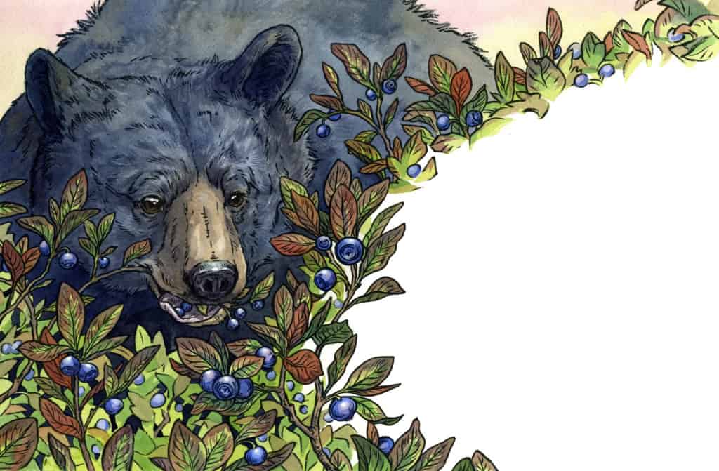 Black Bear | Ursus americanus
As North American bears go, black bears are the smallest and shyest of the lot. They are also the only species of bear commonly found in Oregon and Washington. Smaller and more mild-mannered than their grizzly cousins, they want little to do with humans and would rather run than engage with you. As long as you pack up your food while camping and respect their personal space if you encounter them, sharing the woods with bears is generally a peaceful experience.
In fall, I am conscientious of intruding on a black bear’s important work in berry patches, where they slurp up pounds of fruit a day with their prehensile lips. A bear takes the job of packing on weight for winter seriously and will feed intensely in the weeks leading up to hibernation, a state also known as hyperphagia. Look for bear signs in fall (tracks, scat, and wide paths of flattened vegetation) and steer clear of wild food pantries that have already been claimed.
Cascade Bilberry | Vaccinium deliciosum
The flavor of Cascade bilberry is so wild and sublime that I get a little superstitious about collecting it. It feels so rooted to place that it seems to me the only correct way to taste it is to bring yourself up the mountain, above the forested foothills and into alpine clearings carpeted with dense, low-growing foliage. There, the leaves of the bilberry bush angle up toward the low-hanging sun, tinted red in a visual echo of the wildfire that helps sustain this rare montane meadow habitat.
For animals who live above the timberline, bilberry is a valuable resource. It prefers the highest and coldest elevations, growing sparsely among the peaks in Oregon and becoming more plentiful toward Mount Rainier and into the North Cascades. Its late fruiting season provides a windfall of food and nutrients, the last great community feast of the mountains before the scarcity of winter. Some species even appear to call a temporary truce of territorial or predatory conflicts to work the bilberry bushes side by side: bear beside chipmunk beside grouse, gobbling as much of the fruit as they can hold.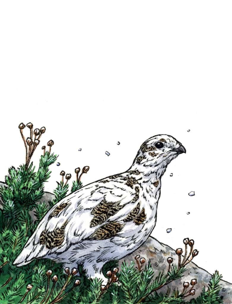
White-Tailed Ptarmigan | Lagopus leucura
A visitor to the slopes far above the timberline of a Cascade peak is likely to encounter scraping winds, freezing fog, and the unsettling creak of glaciers. Up here the snow never fully retreats, and sparse heather and buckwheat hunch close to the earth and scrabble for crumbs of soil among the rocks. This is the year-round domain of a stout little grouse called the white-tailed ptarmigan. When winter arrives, other animals migrate to warmer southern climes or head back down the mountain to lower elevations where food can be found. Unfazed, the ptarmigan sees them all off and prepares to spend the winter as the only creature on the highest slopes. In making this daunting choice a ptarmigan combines the two very best techniques for avoiding predation: becoming invisible and staying where even the toughest predators won’t go.
A ptarmigan’s winter preparation is conducted mainly through molting as it drops its striped and speckled brown feathers and replaces them with feathers of solid white, like snow building up over rocks. The first flecks of white on a ptarmigan’s shoulders in fall are as incontrovertible a sign of winter on the horizon as the first hints of frost in the air. Once the costume change is complete, a ptarmigan will literally sit out the winter, eating plants like heather, saxifrage, and bilberry and moving very little to conserve energy. Insulated by a thick layer of white down, the ptarmigan is concealed in plain sight except for its dark eyes and beak against the snow.

September Can Sting
Not everyone appreciates the romance of crisp fall mornings. Within the nests of western yellowjackets, autumn is a time of hunger and uncertainty. A healthy colony that has been growing and well fed on protein and nectar all summer becomes a hotbed of dissent when temperatures drop, food runs out, and the queen begins to slip into hibernation and release her chemical reign over her underlings. Disorganized, competing desperately for food, and perhaps even aware of their impending mortality when the hard freezes arrive, ornery yellowjacket workers take to heart the words of Dylan Thomas and do not go gently into that good night.
This is a hard fate for creatures that have dutifully worked on nature’s cleanup crew and pollinator team over the warm months. That knowledge has helped me personally find a bit of understanding and empathy for wasps, and these days I more freely offer wasps scraps of the fruits and fats I’m enjoying in the hope that good karma will get me through the season sting-free. But just in case, I also make sure to pack antihistamines in my trail kit.
 Golden-Mantled Ground Squirrel | Callospermophilus spp.
The ground squirrel accompanied me on my ascent to Mount Rainier’s Paradise area, whisking around my ankles and running ahead on the trail before pausing to look back and judge my progress. While it was tempting to ascribe him with benevolent purpose as a guide on the magical slopes, a more pragmatic instinct told me that this bold creature was after food. Sitting upright on the rocks, he assessed me with shrewd black eyes encircled by white fur, wringing his bony little hands and flicking his tail in an impatient gesture. He was so enormously plump from successful autumn foraging (and tourist-schmoozing) that I was shocked at his agility as he scuttled along the rocks. Following my hungry companion up the mountain, I marveled at how everything on Mount Rainier seemed mythically large.
What I didn’t know then is that the Washington Cascades have their own specialized species of ground squirrel. While the golden-mantled ground squirrel (Callospermophilus lateralis) is common in most western mountain habitats, Mount Rainier is home to the
Cascade golden-mantled ground squirrel (Callospermophilus saturatus). This northern species significantly outsizes its counterparts to the south, but you will not typically need to tell the difference between the two because they do not mix ranges—Cascade golden-mantled ground squirrels are contained to a range between the Columbia and Nicola Rivers, and you will not find the more widespread species on those mountains.
It can, however, be handy to know the difference between a chipmunk and a ground squirrel. Chipmunks are noticeably smaller, but the most reliable identification feature to look for is the stripes on their sides that extend all the way up to their eyes, whereas the stripes on ground squirrels stop at their golden shoulders.

Red Crossbill | Loxia curvirostra
It was an autumn evening at the end of another intense wildfire season when the crossbills arrived in our mountain camp. The birds descended in a sudden flurry, and shortly a cloud of dust and a chorus of cheeping began to rise from the firepit that, after several months of fire bans, sat heaped with leftover ashes from the early days of summer. When we came closer for a look, we were greeted by a crowd of crossbills crammed into the metal ring, hopping and scratching and calling to each other. Periodically each one would scoop up a beakful of the ash and chew purposefully, entirely undisturbed by our presence. Pulling our chairs up to the firepit, we watched the smoky golden light of evening illuminate the red feathers of the crossbills like jumping flames. Though our toes remained cold, our hearts were thoroughly warmed.
Watching the birds at work, I racked my brain for an explanation of this behavior and eventually remembered an image of parrots scraping at muddy cliffs to get at mineral deposits. Some follow-up research revealed that crossbills are indeed one of those bird species that maintain the mineral balance in their bodies by consuming ash, rocks, and other seemingly inedible materials. Wood ash in particular is rich in calcium and a valuable supplement to a crossbill’s diet.
The rest of the story of what a crossbill eats can be told by the shape of its beak. At first glance their beaks appear deformed, with the lower mandible curving to the right and the upper one curving to the left (or vice versa—these birds can be right or left “handed”). But this absurd-looking asymmetry is a strategic adaptation to take advantage of physics. Crossbills use these tweaked beaks to open the tough scales of tree cones, inserting the crossed tips under the scale of a cone and then using an open-and-twist motion to lever the scale and snatch the seed tucked underneath. This is a useful tool for the stubborn and fire-adapted cones of the mountains.

Larch | Larix spp.
The larch pushes the boundaries of what it means to be a conifer. It’s fun to imagine prickly traditional evergreens looking on with disapproval as the larch turns its soft needles a gaudy, glowing gold before dropping them entirely to stand scandalously naked until spring.
The yellow is due to some interesting color science: Pigments in the foliage, called carotenoids, give larch needles (and all leaves that turn yellow) their hue. This is present in foliage at all times, but is covered by chlorophyll’s green during the growing season. In other types of trees, pigments called anthocyanins produce a red color when exposed to cold and sunlight. More simply put, a tree that turns red has added something chemically, while a tree that turns yellow has had chlorophyll subtracted; it becomes the true color it always was underneath.
Subalpine larches live at exceptionally high and hard to reach elevations. If you’d rather skip the strenuous hike up alpine trails, consider seeking out the alpine larch’s cousin, the western larch. Western larches are just as yellow and easy to spot on a scenic drive or casual walk through mixed ponderosa forests east of the Cascades. This species requires dryness more than elevation; they scale the northeast side of Mount Hood almost up to the timberline but barely make an appearance on the foggy slopes of Mount Rainier.
Fall Raptor Counting
Most of the Pacific Northwest falls under the Pacific Flyway, a band of airspace stretching from Alaska to Patagonia that forms the route many bird species take in their annual migrations. The dynamic topography of the mountains creates updrafts and thermals that birds like to ride, so a long chain of mountains like the Cascades is a convenient wind tunnel to a migrating hawk.
Just as whale watchers gather on the coast to observe gray whales on their migration route, birders flock to certain prairies, lakes, and mountains to see the seasonal flow of birds. For many, it’s a chance to see species that are only in the region briefly.
One such site is the Bonney Butte HawkWatch, a raptor research site located on the southeastern shoulder of Mount Hood. The site is busy from late August to late October with HawkWatch International staff and volunteers counting and banding raptors to monitor the population health of migratory species like the golden eagle, sharp-shinned hawk, and turkey vulture. Bonney Butte is open to the public, and any curious birder is welcome to visit and watch the count.
Even if you aren’t within range of a research station, the project of monitoring migratory species is something that we all can participate in through the magic of citizen science in the digital era. Convenient tools like iNaturalist and eBird allow anyone with a smartphone to log information about bird sightings, which can then be verified by scientists who collect and refine data that will eventually be used to help make decisions about land management and species conservation.
Excerpted from CASCADE OF LIFE by Emily Poole (September 2026). Published by Skipstone Books. All rights reserved. Used with permission from the publisher.
About Cascade of Life:
 Cascade of Life invites readers to step beyond the typical field guide and into a deeper dialogue with the natural world. Artist and naturalist Emily Poole explores the wondrous variety of the Pacific Northwest – from rocky shorelines to alpine slopes to arid steppes – through the rhythms of the four seasons, spotlighting species that are especially active at different times of year. Original illustrations and essays feature popular species like gray whales and Anna’s hummingbirds, as well as overlooked or misunderstood plants and animals, such as pickleweed and coyotes.
Blending stunningly vivid paintings with personal anecdotes and field-based insights, each chapter encourages the reader’s curiosity and offers accessible, hands-on activities to deepen their connection with nature. Part field guide, part journal, Cascade of Life is a welcoming, inspiring exploration of Cascadia’s landscapes and the species that define them.
About Emily Poole:
 Acclaimed artist EMILY POOLE has been exploring the wild spaces of the western United States since childhood. Her work has been used by organizationssuch as Creature Conserve, HawkWatch International, and the National Museum of Wildlife Art and has appeared regularly in High Country News. Her illustrations have been featured in six natural history books, including BirdNote, Northwest Know-How: Trees, and A Little Book of Hummingbirds. She lives in Eugene, Oregon. Find her online at epooleart.com.
Link to purchase:
The post The Mountains in Fall first appeared on North Cascades Institute.
]]>The post Nature of Writing: Creative Process for “Mountainous” first appeared on North Cascades Institute.
]]>
It’s a different kind of adventure than the type I’ve been chasing for the past decade: the snowy and rocky type. I’ve eagerly measured my own growth in horizontal miles and vertical feet, but also in physical and mental strength. Sometimes this progression was explosive, and sometimes it stagnated or grew only in spurts. It only took me a year to learn how to rock climb, but it took me five more to manage my fear of falling.
My daughter and I are growing and aging on different tracks, just two creatures in a world full of change both big and small. The more time I spend outside, the more I see the landscape as a third character in our adventures. What will the mountain do today? How will the trail look after a year away? And what is the likelihood of rockfall along this route?
My new book Mountainous is a product of all of these thoughts. Change is inevitable for all inhabitants of this world, even the biggest of mountains. These dynamic mountain environments are subject to forces that we are all too aware of, such as earthquakes and volcanoes. What I found even more intriguing is the change that their sheer size seems to generate, from creating their own weather systems to erosion via the weight of their own glaciers.
The dreamiest spread of the book imagines the girl and her mom moving, large like mountains, through the landscape of Mt. Roraima in South America. I hope readers can picture themselves being like a mountain on days they are constantly in motion, humming and swaying. Or on other days they can be just like a mountain that is slow and calm, stretching out into the horizon.
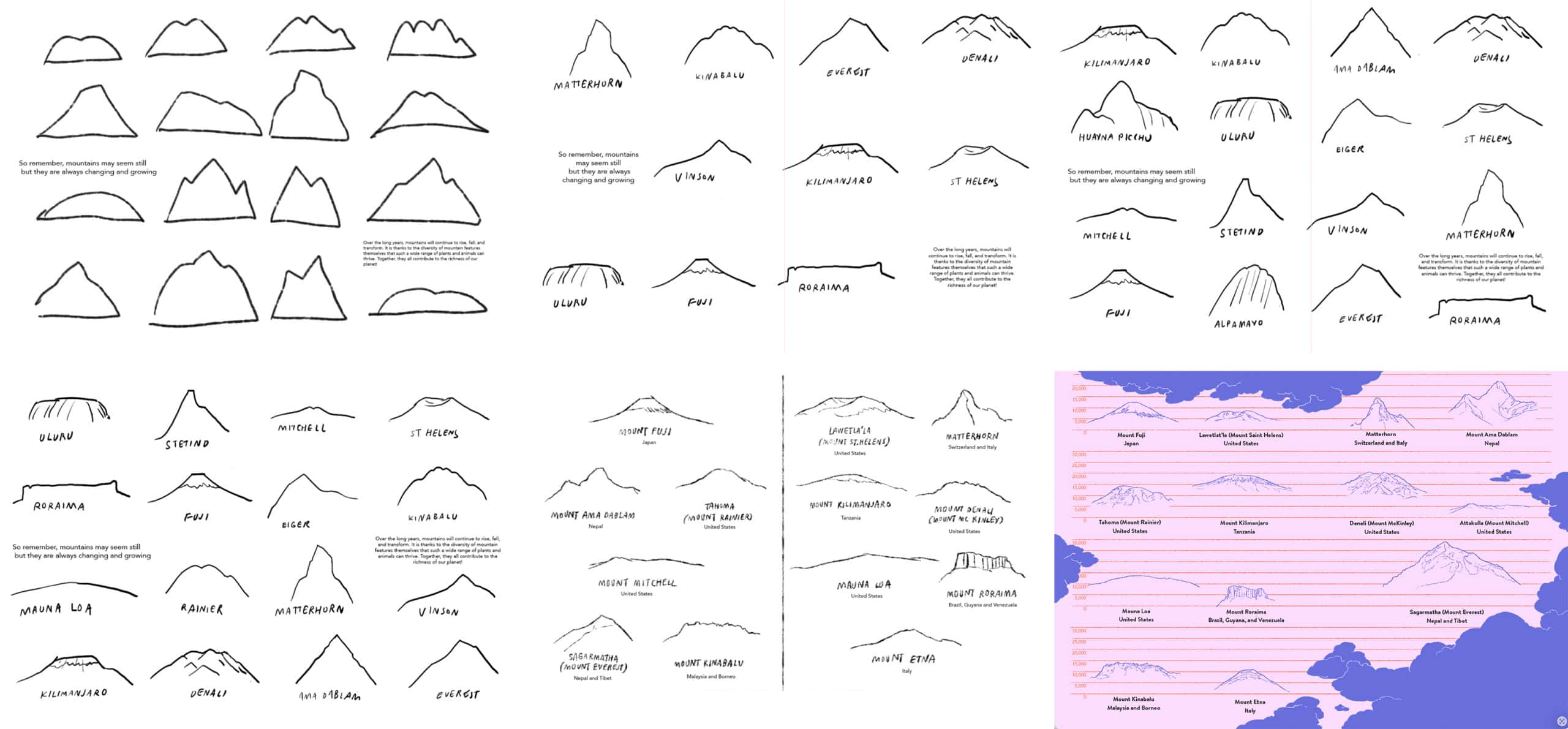
I spent a lot of time thinking about which mountains to illustrate and write about in this book. I wanted to make sure there was variety: old, low mountains (the Appalachians) as well as tall mountains that are still growing (Sagarmatha/Everest). I included mountains that sit in famous alpine areas (Ama Dablam, Matterhorn) and mountains that stand on their own (Mt. Kilimanjaro). I wanted visual variety, too, so in addition to the stereotypical triangle mountain shape, I made sure to include low and sloped mountains, flat-topped and caved-in mountains, and jagged ridgelines. I also included mountains that I have personal attachments to, such as Tahoma/Mt. Rainier and Lawetlat’la/Mt. St. Helens.
The 1980 eruption of Lawetlat’la/Mt. St. Helens was such a significant chapter in US volcanic history and perhaps one of the most dramatic illustrations of change that a mountain can undergo. Eager to learn more, I signed up for a volcano naturalist class with the Mt. St. Helens Institute in 2023, just when I was beginning to write Mountainous. We heard from the Cowlitz tribe, listened to first-hand accounts of the eruption, and learned from geologists and historians. The class ended with a trip to explore Ape Cave and some of the mountain’s smaller lava tubes!
Mountainous is all about pairing the big and small change mountains go through with human change. It might have been natural to pair the violent eruption with some type of decline or death, but I wanted to find another example of human change that is dramatic and transformative. After some experimentation, I paired the eruption with the relatively big changes a toddler goes through in the first couple years of life. My daughter was just learning to crawl when I was working on the sketches. I finished the book right around the time that she started walking. Dramatic and transformative, indeed!
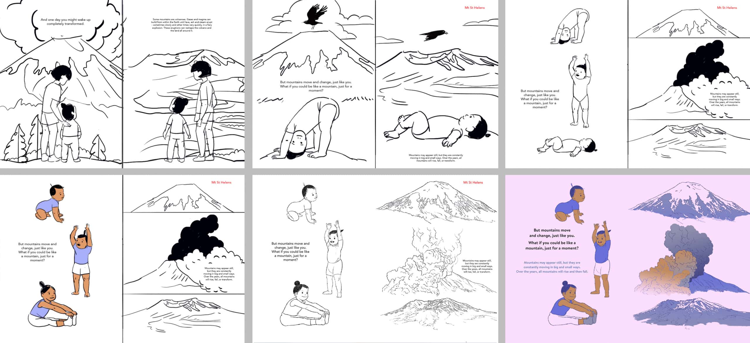
Perhaps my closest connection to mountains is with Tahoma/Mt. Rainier. I have had wildly different experiences on these mountain slopes, from climbing past seracs in the middle of the night to pushing a stroller around Paradise visitor center. It would be hard to condense my experiences of the mountain into one illustration. Similarly, there is so much to say about mountain ecosystems and change that it’s hard to distill any one mountain into one thought or sentence.
We should talk about the many different ways to address this mountain: Tahoma, Tacoma, and Takhoma – the names used for centuries by the indigenous tribes who call this area home. The name Mt. Rainier is only a couple centuries old – a blink of an eye for a mountain – and it was named by George Vancouver for his friend.
We should choose to write about the retreating snow line, about how the snow has been disappearing earlier every year and the crevasses have become exposed at an earlier date almost every summer.
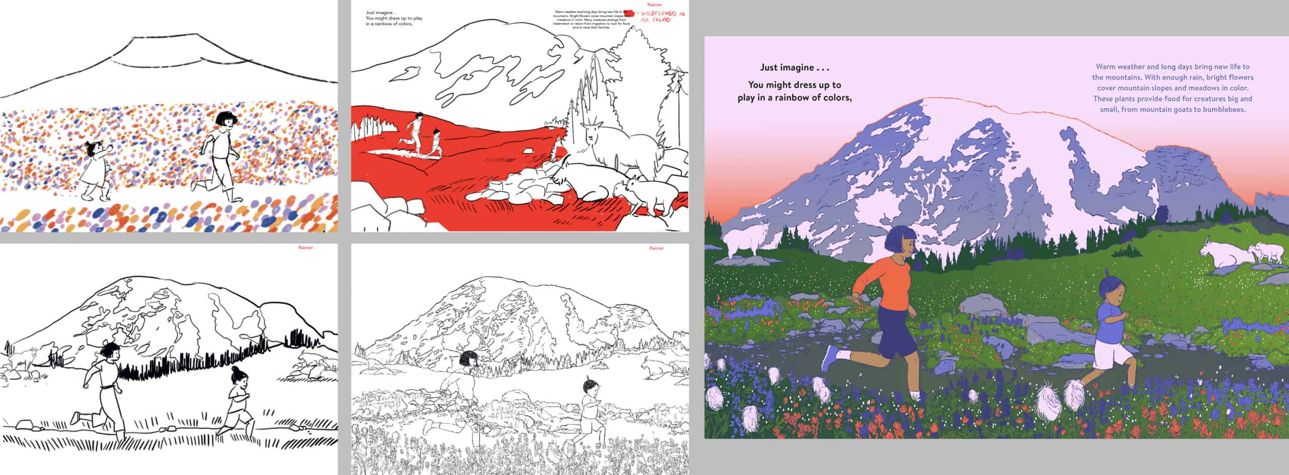
For this particular spread, I chose to illustrate and write about the wildflowers. Visitors flock to Mt. Rainier National Park during the summer months to see the riot of colors that bloom all over its slopes. The accessibility of visitor centers like Paradise make it possible for all types of people, with different mobility and ages, to experience the wonder of an alpine summer. I believe that access is a hugely important part of our relationship to nature, as to protect a place you must first know and love it.
There is so much we can say about the way mountains and their ecosystems change through time. There is even more we can say about human growth and decline. I know we have only scratched the surface of some very large topics, but I hope you’ll enjoy thinking about it as time passes – whether that is at a snail’s pace or in the blink of an eye!
Excerpt from “Process for Mountainous” by Julia Kuo, originally published on juliakuo.com. All original artwork by Julia Kuo for Mountainous (Greystone Books, October 2026). Shared with permission. All rights reserved.
The post Nature of Writing: Creative Process for “Mountainous” first appeared on North Cascades Institute.
]]>The post YLA 2026: Growing Together in the North Cascades first appeared on North Cascades Institute.
]]>
Many YLA students sign up because they want to go camping, backpacking, or just see the shimmering blue water of Ross Lake; they wind up leaving for their downstream journey with so much more.
On the first night of a trip this summer, we had an especially multilingual crew. Students and staff were swapping vocab and common phrases in Ukrainian, French, and Spanish. It’s not on every backpacking trip that you’re making new friends in so many different languages!
Over the course of the trips, students opened up to their trip mates. One student who was initially quiet and withdrawn from the group, opened up more and more as the trip went on. 
At Community Day, they shared that they’d love to help other students have experiences like this in nature. “I learned that I can actually work with people I only knew for a couple of days and not be as anxious as I usually am. It makes me want to meet new people and go out into the world more!”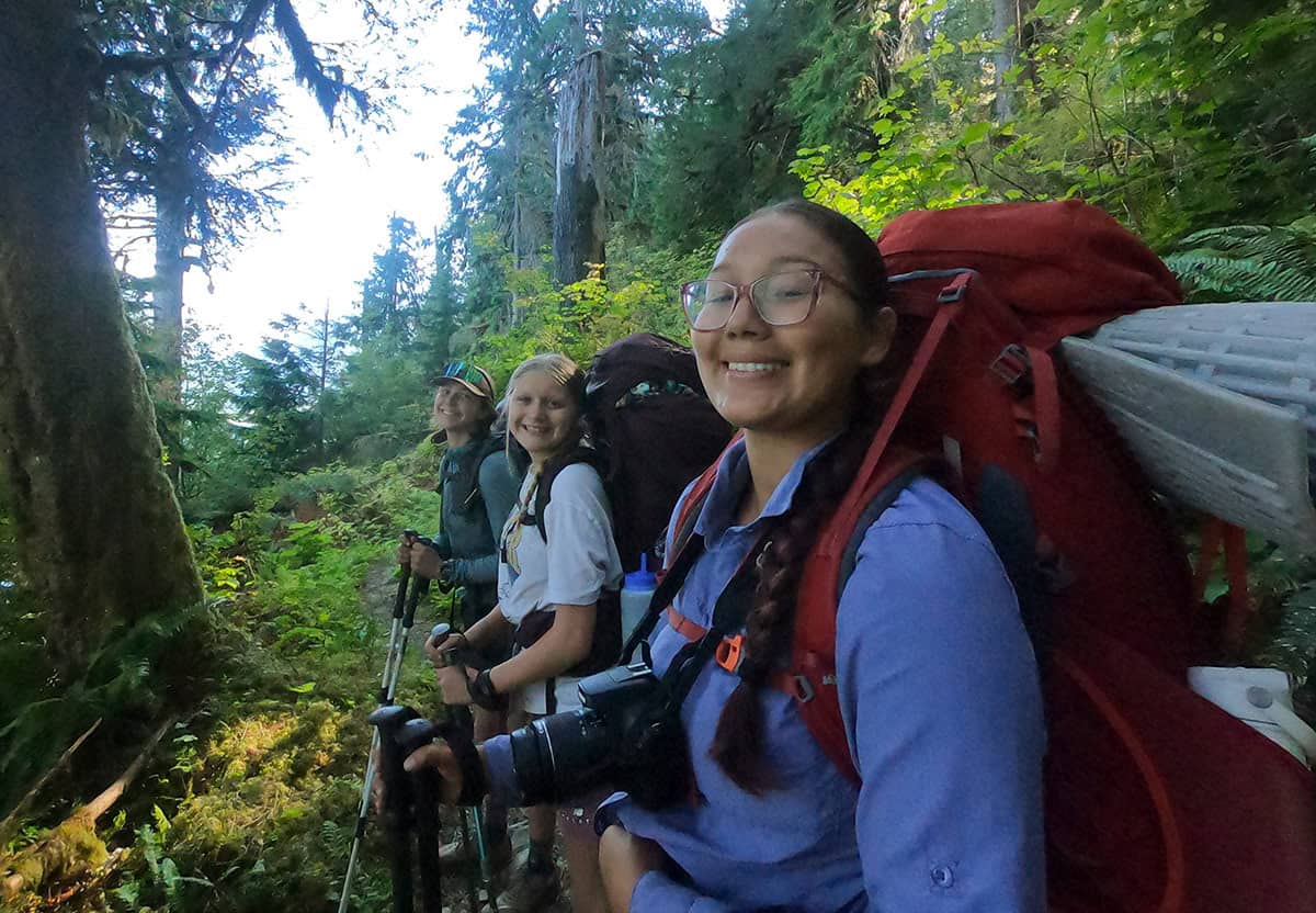
In addition to new friends, YLA students gained new appreciation for the environment. One student shared that “after experiencing the beauty on this trip, I think that I now have a deeper connection to nature and have more gratitude for the natural world.”
YLA students also supported and explored their public lands over the course of the trip. On every eight day trip, students and instructors did service work in North Cascades National Park and Mt. Baker-Snoqualmie National Forest. This often looked like clearing trails, clipping back bushes, and cleaning up litter.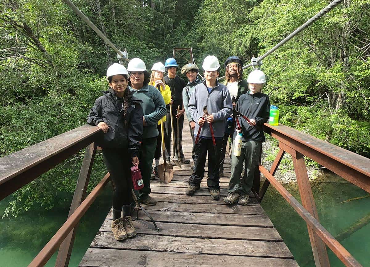
Service helped students see what goes into keeping these special places accessible and give back. “Being a part of the group, helping out my friends, and the Park Service showed me that I can be helpful.”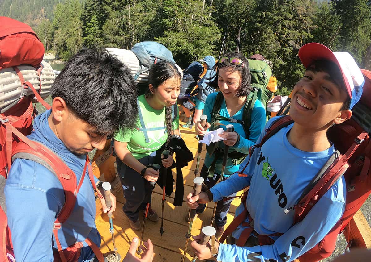
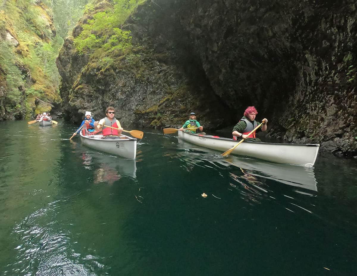
This summer YLA hosted several indigenous students who had lots of experience canoeing in traditional Coast Salish canoes. Including one student who joined their YLA trip right after they completed a Canoe Journey with other youth from their tribe. Of their experience on the trip, they said: “I felt most inspired while being on the canoe. I felt close to how my ancestors did.”
While these trips were just a week away from students’ regular lives, our 2026 participants experienced deep reflection, quiet in nature, and grew as leaders. Thank you to all of our YLA students for your curiosity, bravery, and tenacity. You inspire us all to take more action in our communities!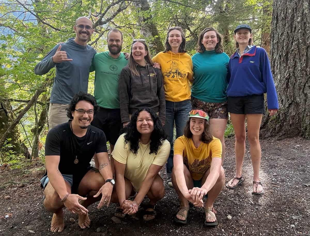
Thank you to the YLA Team! YLA Program Managers Kate Little and Neal Smeltzer, YLA Program Coordinators Kéan Schutte and Colleen Roberts; and Instructors Jenny Garcia-Barrera, Megan Paluska, Bella Lucente, Mykey Pazen, and Lydia Yates.
Written by Kate Little, photos by program staff. See all YLA 2026 trip photo albums at flickr.com/ncascades.
The post YLA 2026: Growing Together in the North Cascades first appeared on North Cascades Institute.
]]>The post Why Do Larch Trees Turn Gold? And Why Is That So Weird for a Conifer? first appeared on North Cascades Institute.
]]>Welcome to larch season!
Larches are some of the most unusual trees in the North Cascades. They have needles. They grow cones. They look like evergreens for most of the year. But when fall arrives, they do something most of their conifer neighbors don’t do. They turn gold and drop all their needles.
So why would a conifer bother turning gold before going completely bare?
Why do larches turn gold?
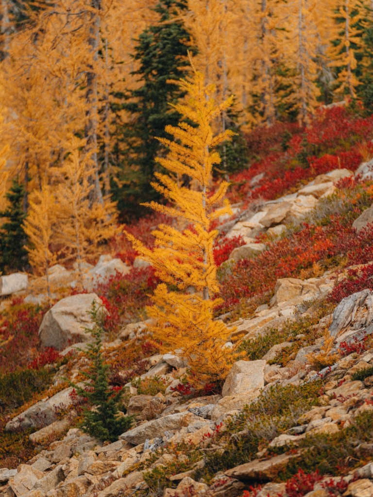
Like other trees, larches use chlorophyll to capture sunlight and make energy during the growing season. That chlorophyll is what gives their soft, feathery needles their green color throughout spring and summer. But autumn changes things.
As the days get shorter and temperatures drop, the tree starts preparing for winter. It pulls useful nutrients out of its needles and stores them in its branches and roots. As the green chlorophyll breaks down, other pigments that were already there become visible and suddenly, green becomes gold. Eventually, the tree lets go of its needles altogether.
It might seem like a strange thing for a conifer to do, but in the North Cascades, it makes sense. Winters can be cold, snowy, windy, and long, especially at higher elevations. Rather than spending energy maintaining thousands of needles when there isn’t much sunlight available, larches drop them and wait out the winter. Then spring comes around, and fresh green needles grow back.
A conifer that doesn’t act like a conifer
Most of the conifers you’re likely to see in the North Cascades stay green throughout the year. Firs, spruces, hemlocks, and pines keep their needles through winter. Larches don’t get that memo. They’re deciduous conifers, which means they’re conifers that lose their leaves, in this case needles, every year.
There’s another easy way to recognize them. Larch needles grow in little clusters along the branches, giving the tree a soft, feathery look. Once you’ve seen one up close, they’re surprisingly easy to pick out. (Highly recommend shaking the “hand” of a larch, IYKYK)
And then there’s the obvious clue in October, if a tree looks like an evergreen that has suddenly been dipped in gold paint, there’s a good chance you’re looking at a larch.
Larch March: Where and When to See Golden Larches
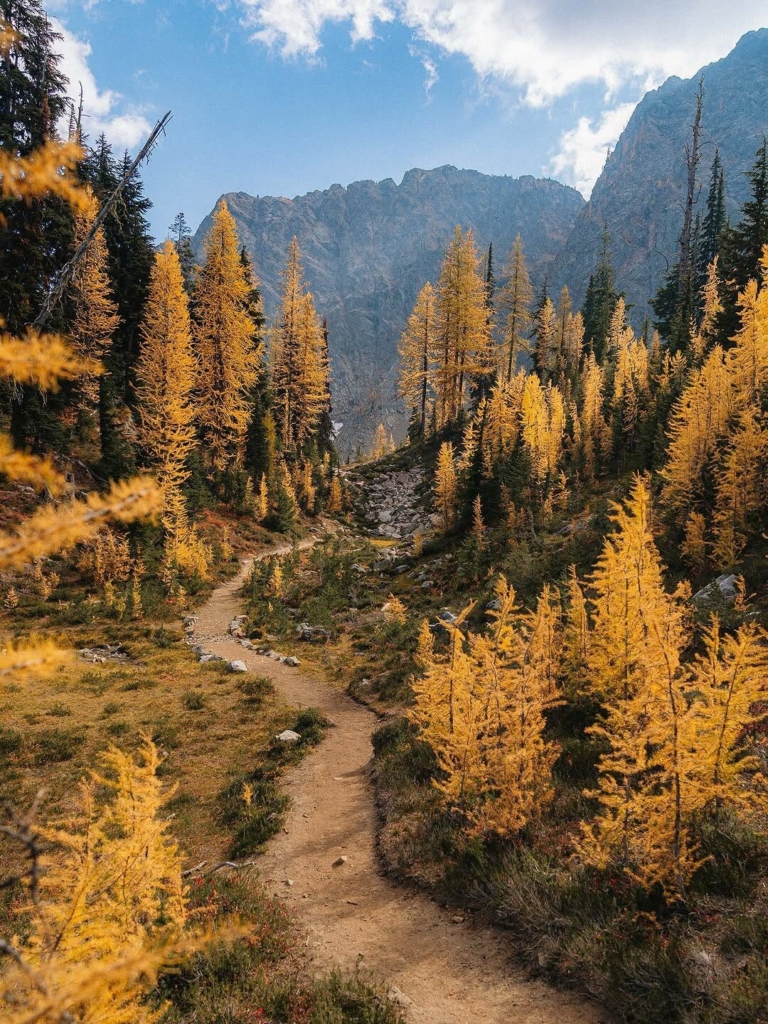
For a classic North Cascades larch experience, head into the high country in late September and October. The exact timing varies with elevation and weather, but higher-elevation larches can begin changing around late September, with the golden display often reaching its peak in early to mid-October.
Some well-known places to look for subalpine larch include Easy Pass, Fisher Basin, McAlester Pass, McAlester Lake, Purple Pass, and the Juanita Lake area.
The trick is timing. Larch season can be wonderfully brief. One week you may be walking beneath glowing golden branches; a short time later, the needles can be carpeting the trail.
And you’re definitely not the only one who wants to see them. If you decide to take a larch march, pack your patience. Popular trails can get crowded during peak color, so have an alternate hike in mind. Check road and trail conditions before you head out, and remember to practice Leave No Trace principles.
Two Larches, Two Mountain Neighborhoods
The North Cascades are home to two different larches, and knowing where they live can help you find them.
Western larch prefers the drier forests of the eastern Cascades. It can grow into an impressive tree, towering above the forest and developing a broad, open crown with age.
Subalpine larch is the high-country specialist. You’ll find it at higher elevations, often scattered across rocky slopes, mountain basins, and open areas near treeline. Its twisted, weather-beaten appearance is part of its charm, it has to endure some seriously tough mountain weather.
A few fun larch facts
- They’re conifers, but they’re deciduous. That’s probably the easiest way to describe what makes larches so unusual.
- Their needles are soft. Give one a gentle feel and you’ll notice how different they are from many other conifers.
- They grow cones. Look closely and you’ll find small cones tucked among those clusters of needles.
- Their gold color is temporary. The needles eventually fall, leaving the tree bare for winter.
- They start over every spring. Once winter is over, fresh green needles grow back on those bare branches.
Go for the gold
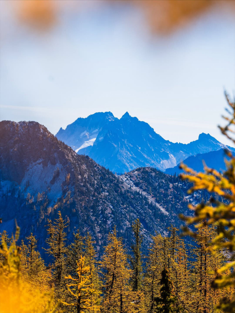
There’s something pretty satisfying about knowing what you’re looking at when you hike through the North Cascades. So this fall, if you see a hillside glowing gold while the surrounding evergreens stay green, take a closer look. You may have found a larch.
And if you’re lucky enough to catch them at peak color, stop for a minute. Take a photo, but also take a look around. For a few short weeks, the North Cascades put on a pretty incredible show, green trees everywhere, with patches of gold lighting up the mountains. It’s worth planning a hike around.
Happy larch season!
Top photo by Wei Ling
The post Why Do Larch Trees Turn Gold? And Why Is That So Weird for a Conifer? first appeared on North Cascades Institute.
]]>The post In the Range of Fire & Ice: Peopling the Passes first appeared on North Cascades Institute.
]]>There we found an unexpected site: three NPS rangers dressed in bright-red jackets. They were waiting for a helicopter. No one was injured, the standard reason to wait for a helicopter in a national park. Instead, the helicopter was coming for a far more mundane reason, ferrying two 50-gallon metal drums, a shovel, and a sledgehammer for the once-every-few-years emptying of the pit toilet. Not everyone gets to experience such a changing of the guard.
Wide open and level, the meadow at the pass had a ground cover of heather, huckleberry, sedges, and partridgefoot and islands of mountain hemlock and subalpine fir. To the north, the Sahale Arm—the broad shoulder of Sahale Mountain—extended up to ice and rock. To the south, the fractured, rocky summits of the Triplets, Mixup Peak, and more ice. East lay Pelton Creek, disappearing down a bend in a rocky valley toward Stehekin and Lake Chelan. To the west, rising behind the valley we had ascended, stood the great massif of Eldorado Peak, skirted by the Eldorado and Inspiration Glaciers. Unfortunately, we had arrived only days after fires had started to cloak the air. It was far cleaner than it had been in Seattle (which for a short time had the dirtiest air of any large city in the world), but the peaks lacked their alpine crystallinity. Instead, they were gauzy, the light flat and sickly tinted.
Now that we knew the toilets would soon be clean, we ate our lunch on a rock platform built to protect the fragile ecosystem. In the unregulated camping era, before the creation of North Cascades National Park in 1969, more than one hundred people used to camp nightly in the meadows. Soon after the creation of the park, camping became restricted to designated reservation-only sites in order to protect plants and animals.

Descending the east side of the pass after lunch, we were soon squeaked at by pikas, who had also been active on the other side of the pass. Both areas are pika utopias, with labyrinthian rock cavities for nesting and caching and widespread tufts of vegetation and nearby meadows for food. Whereas our previous pika-less experience at Wind Mountain had been damp and misty, the weather was warm and sunny, and the pikas were out doing what makes them so loved: eeenk-ing and looking cute, perched atop rocks, observing their domain, and in some cases sitting next to their also-cute peppercorn-like scat. One aspect of pikas I like, in contrast to chipmunks and ground squirrels, who often beg for and steal food, is that the more dignified pikas usually vanish like liquid into their lithologic homes when disturbed by people. I know that’s an anthropocentric view, but I respect pikas for their ability to disdain us and remain true to their nature.
For our first night, we camped on the east side of the pass, down in the trees of Pelton Basin. It was an official NPS camp, one of the designated locations where we could overnight legally along trail corridors in the park. Because of bears, one of whom had recently deposited a seedy purplish turdiform splat in the middle of a campsite path, we stored our food and any other human-smelling products in a bear-proof metal box and cooked our meals in a designated area, isolated from the tent platforms. We later saw a black bear a few hundred feet from the camp.
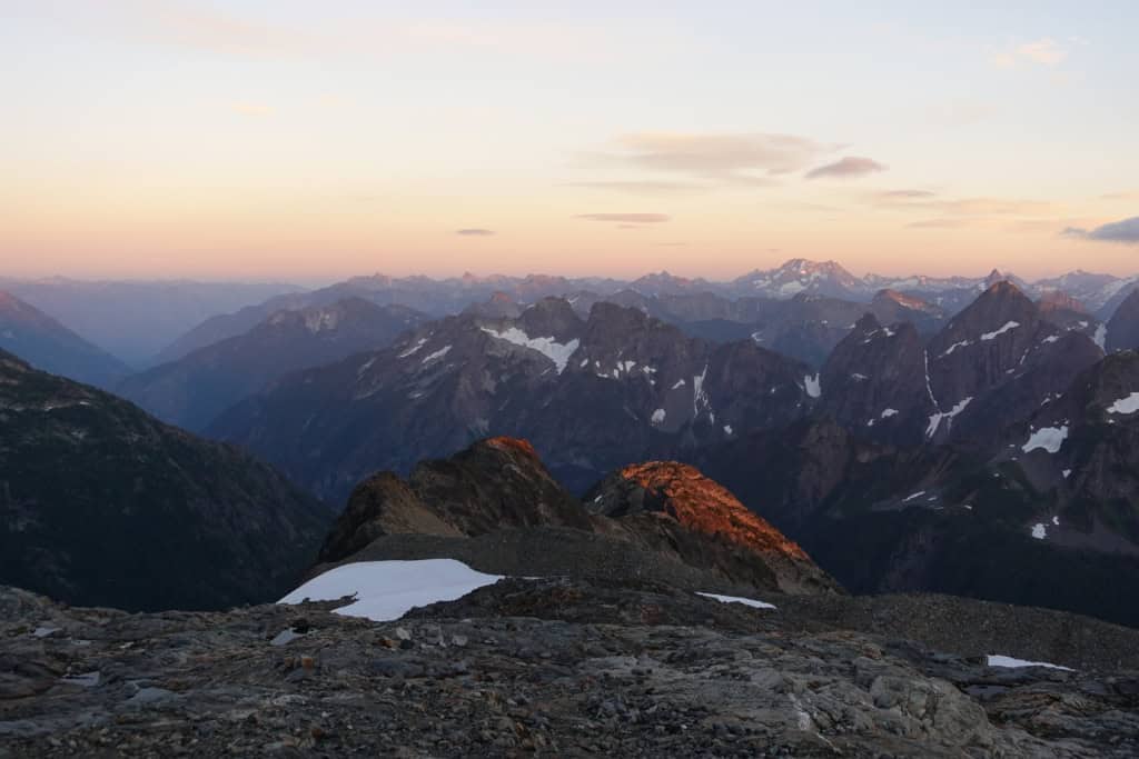
Night two found us at another designated NPS campsite, on Sahale Arm, a little over two miles north and two thousand feet higher than the pass. Unlike the previous night, which had been cool and mostly clear—the starry night had brightened my midnight constitutional—a series of rain, wind, and thunder cells cuffed our tent, well above tree line and only lightly protected by a wall of stacked boulders. We took advantage of the calm between cells to cook, pump water, pee, and reanchor our tent to the surrounding boulders. When the weather calmed after four or five hours of pounding, it was quiet enough to hear rockfalls crashing off the nearby walls. Since we were on an isolated mound, we weren’t worried about the rocks.
The view from Sahale the next morning was a stunning tapestry of jagged peaks, a cirque-bound mountain lake, and glaciers, the view unimpeded by trees. But I was most thrilled by the cloud rivers. From our high-elevation perch, we watched clouds that had streamed up the Cascade River valley and found the low gap at Cascade Pass. The day before, the cloud river initially couldn’t crest the gap and looked like a giant wave, just breaking in a few places across the divide. Then the wind shifted, or the pressure changed, and the clouds broke through, shooting misty currents to the east. In the early morning, the clouds had retreated, eddying well below the peaks, some of which just pierced the white to form sky islands. But now, as we descended, the cloud layer thickened and, once again, thin, vaporous streams burst through Cascade Pass, still one thousand feet below us.
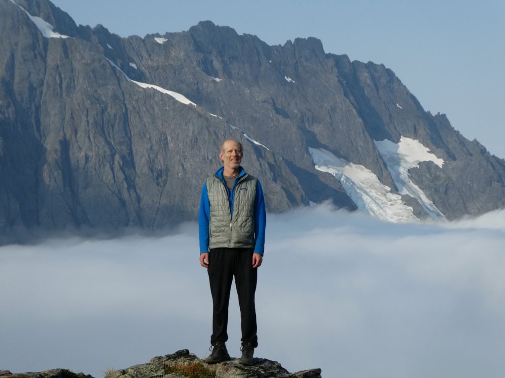
Just as the weather systems here follow the topography, I wonder if people in turn followed the clouds. Had early visitors trailed the diaphanous rivers up to the relatively low-elevation Cascade Pass to traverse across the North Cascades? We know from tools and other implements found at the pass that the first people at the gap arrived ten thousand years ago. I can easily imagine that people who relied on paying attention to environmental conditions for their survival would have understood that the streaming clouds probably indicated a low divide. They would have been further informed by the westward-flowing Cascade River, a source of water and salmon as well as other plants and animals they might desire.
People appear to have continued to visit Cascade Pass regularly, even returning after volcanic debris rained from above, burying their camp, cook, and tool-working site. In doing so, the countless generations of mountain travelers left behind a detailed view of how people used the subalpine and alpine zones of the Cascades. They were not alone: Cascade Pass is one of many passes that show how these low divides facilitated access into the mountains and their resources, and across to other resources and other people.
Excerpted from In the Range of Fire & Ice: A Human and Natural History of Washington’s Cascades by David B. Williams (September 2026). Published by Mountaineers Books. Reprinted with permission. All rights reserved.
Book links:
The post In the Range of Fire & Ice: Peopling the Passes first appeared on North Cascades Institute.
]]>The post Weekend for All: When Access Becomes Belonging first appeared on North Cascades Institute.
]]>And just like that, the third annual Weekend for All has ended!
Each year I always have a little bit of a hard time when it ends. There is so much planning and hope that goes into making this weekend happen. But there is truly something special about watching participants arrive, sometimes not knowing what to expect, and then watching them settle in, explore, laugh, learn something new, and connect with one another, or simply do nothing but recharge.
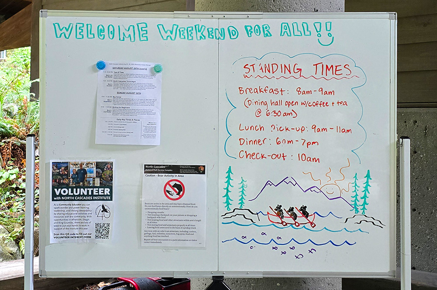
Weekend for All was created by North Cascades Institute with a focused commitment to outreach and engage with populations who have been historically underserved and lacked equitable access to public lands. People who have not always felt welcomed at our public parks. Because access isn’t just about whether someone can physically enter a park. It’s also about whether they feel like they belong there once they arrive.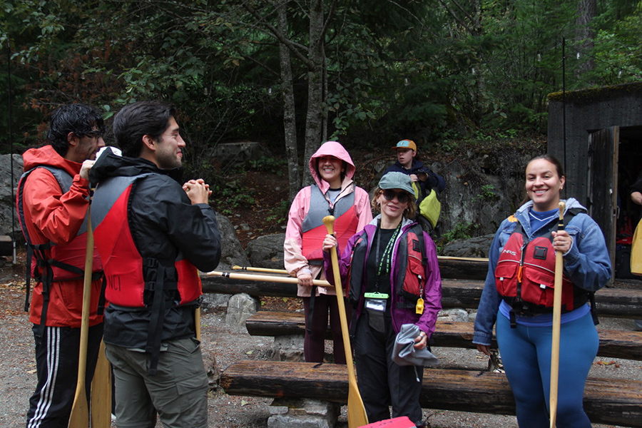
This year our outreach and engagement was more expansive. For the first time, many of our participants were returnees. We also welcomed people who traveled from as far away as the South and Southeastern region, including: South Carolina, Mississippi, Tennessee, and Washington, D.C.
There was something wonderful about seeing familiar faces alongside people who were experiencing Weekend for All for the first time.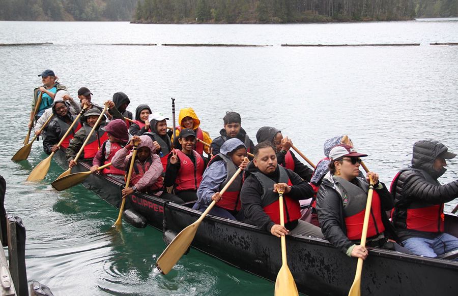
So, the weather didn’t quite cooperate as it wasn’t the sunny, hot weather we’ve had during previous Weekend for All weekends. But that didn’t stop anybody. Participants enjoyed the same activities, and as always, the big canoe was a hit! The watercolor class was popular, as was the bird walk led by the Institute’s own graduate, Chris Williams, which gave participants another opportunity to slow down, look around, and experience the Environmental Learning Center in a different way.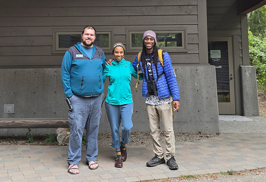
But what I noticed most this year wasn’t necessarily the activities. It was the people.
This year’s Weekend for All felt like we had reached a groove. Though the programming was still structured, there seemed to be more ownership from the participants who made the weekend their own.
Possibly, some of that came from how lodging was arranged. Participants were randomly assigned and no longer offered lodging according to the group they belonged to, which gave people an opportunity to get to know others they may not have otherwise met. And they did.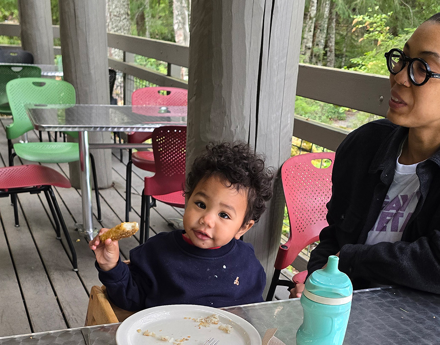
That’s part of what Weekend for All is really about. It’s about access to public lands, but also about creating opportunities for people to see themselves in these spaces, to feel welcomed, and also to connect with others who may have had similar experiences, or completely different ones.
And like last year, most participants said they would return. Many also said they would tell others about Weekend for All or bring someone with them the next time. Several participants also shared how grateful they were for this opportunity provided by North Cascades Institute. 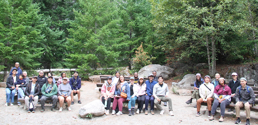
I am also grateful that the Institute has committed to integrating Weekend for All into their regular programs. Because when people have historically been told, directly or indirectly, that certain spaces aren’t for them, an invitation can mean much more than simply opening a door.
It can be the beginning of belonging.
*Thank you to Seattle City Light and Washington’s National Park Fund who made this weekend possible!
The post Weekend for All: When Access Becomes Belonging first appeared on North Cascades Institute.
]]>The post Looking Back at the Flowers, Frogs & Frolics of Summer first appeared on North Cascades Institute.
]]>Natural Dyes Workshop in the Chuckanuts
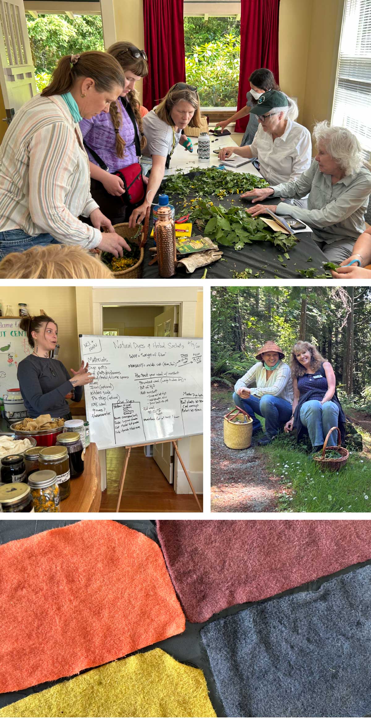
Participants spent a beautiful sunny day in the Chuckanuts learning about the traditional uses of various native plants and collecting invasive species to turn them into something beautiful! Dandelion, creeping buttercup, and more went into the vat to produce a beautiful yellow natural dye.
Amphibians of PNW Ponds and Wetlands
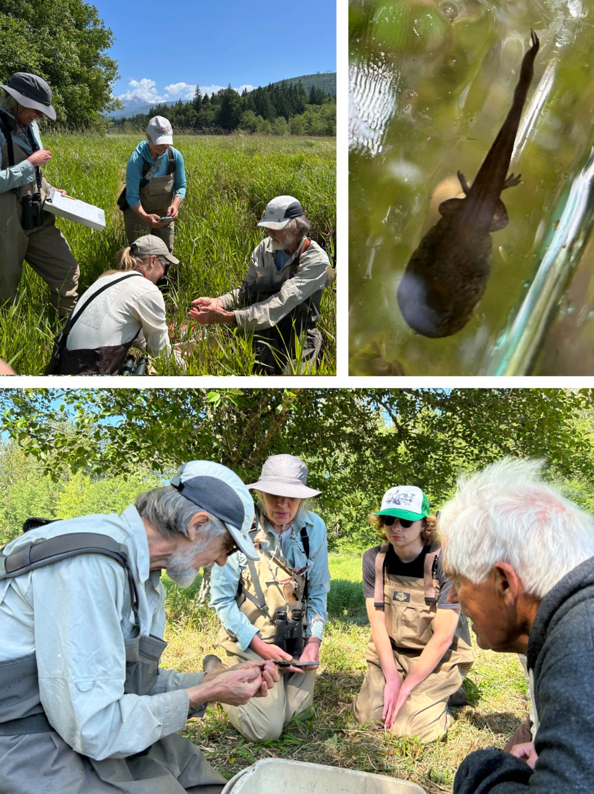
Can you say “RIBBIT”?! This annual amphibians course got us up close and personal with water loving critters of all kinds! Thanks to wildlife biologists at the Whatcom County Amphibian Monitoring Program (WCAMP), we handled frogs and salamanders safely while learning about habitat restoration work being done for the endangered Oregon spotted frog. This made us want to hop along to the next Whatcom Land Trust work party to volunteer!
Flowers and Field Journaling on Sauk Mountain
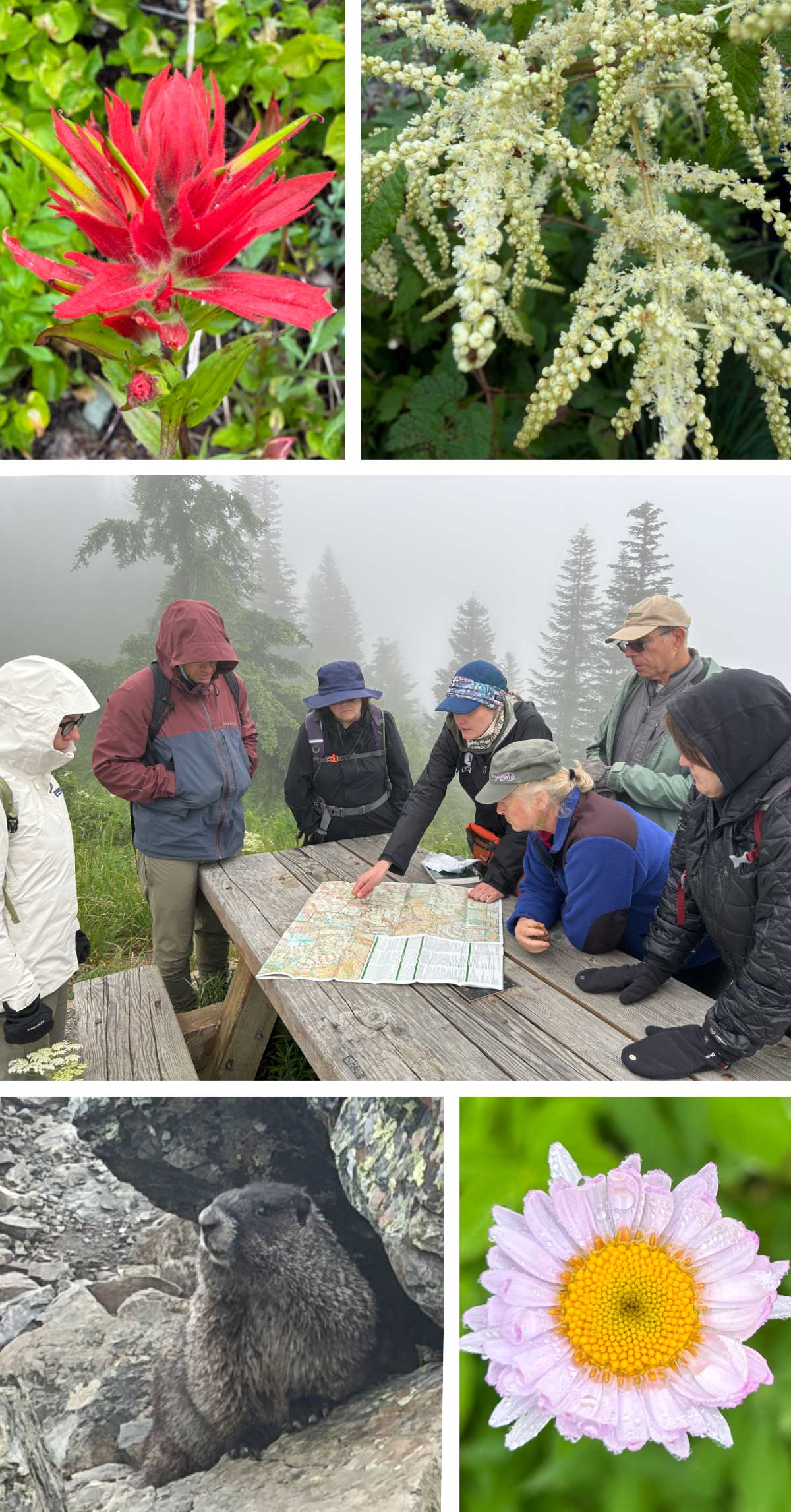
We may have been socked-in on Sauk mountain, but that didn’t dampen anyone’s spirits. While learning how to use the practice of field journaling to connect to place, participants observed more than 20 different species of wildflower. As an added bonus, we got to hang out with a pika, a pair of marmots, and one very intrepid banana slug at the top!
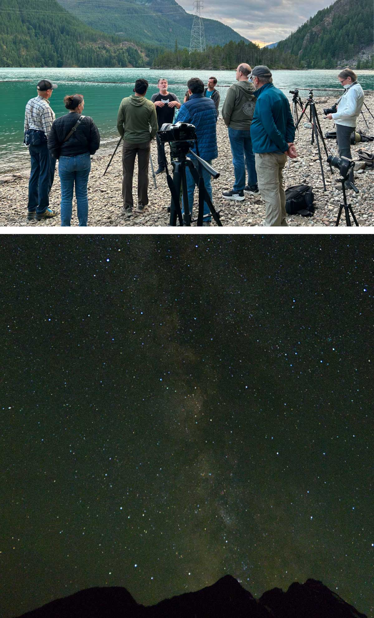
North Cascades Night Sky Photography
Summer nights are for stargazing and contemplating your place in the universe. Participants in our Night Sky Photography class did just that as they captured beautiful shots of the Milkyway shining above the craggy peaks of the North Cascades and reflected on the importance of protecting our dark skies.
Narrative Nature: An Observation-based Writing Workshop
The contemplation continued with Narrative Nature as participants wrote and reflected as they made their way up the Sourdough Creek Trail. After a full day of exploring our relationships with the natural world, the class gathered for one last discussion over burn-ban s’mores.
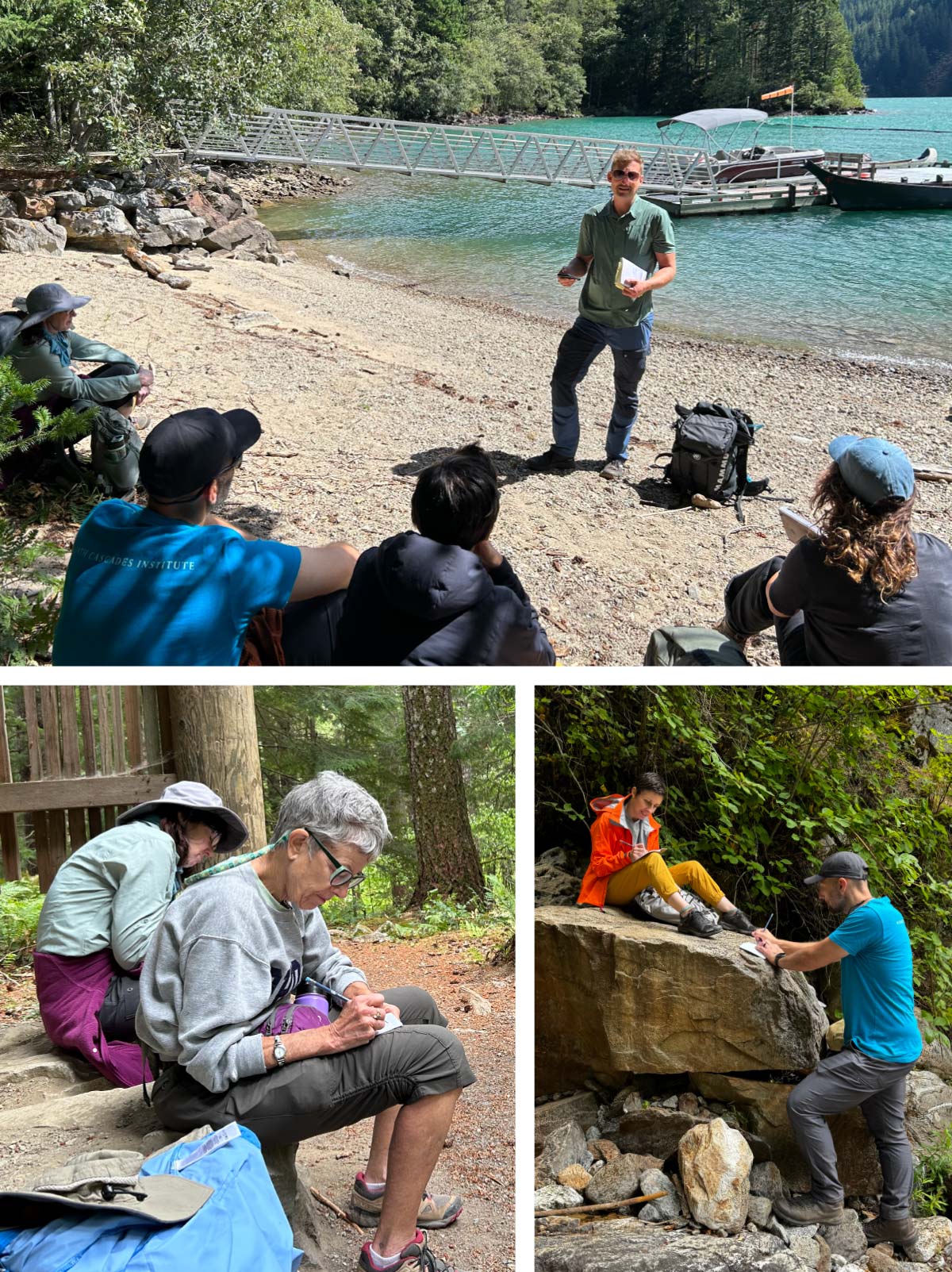
One participant shared that for her, the act of writing is akin to the act of paying attention, and that paying attention is love embodied. Therefore, in writing about the North Cascades, we fall in love with this place all over again.
Exploring the Geologic History of the Skagit River
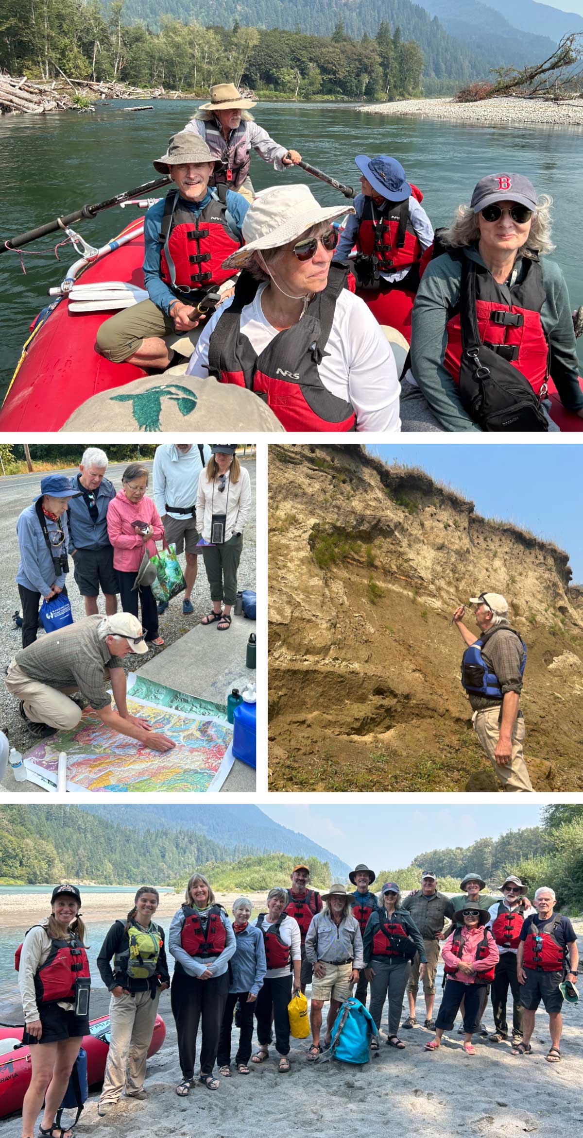
Participants in this adventure spent two full days ‘getting rivered’ – going with the flow and learning to recognize the incredible power of water and ice to shape the landscape over thousands of years. We took lessons learned in the classroom on the road and then on a raft to see first-hand evidence of ancient glaciers, volcanoes, and landslides. Not a bad way to spend a summer day!
Upcoming Opportunities
Have we piqued your interest in Institute learning adventures? Visit ncascades.org/classes to join us for these Fall & Winter 2026 field courses, online classes, and workshops at the Environmental Learning Center (ELC):
Oct 3 | Beat Poets of the North Cascades with Nathan Drapela – Thunder Arm
Oct 7 | Drawing and Painting Orcas with Sara Shimazu – online
Oct 16-18 | North Cascades Fall Naturalist Seminar with Chris Byrd – ELC
Oct 21 | A Year in the Life of North American Woodpeckers – online
Oct 24-25 | Lichenology 101 with Hannah Prather – Northern State / Baker Lake
Oct 31 | Baker Lake Fungal Foray with Erin Moore
Nov 4 | Cougars in the Pacific Northwest with WDF&W’s Brian Kertson – online
Nov 12 | Scientific Botanical Sketching with Crystal Shin – online
Nov 14 | Introduction to Tracking with Matthew Fortin – ELC
Dec 2 | Forest Health in the North Cascades with Rachel Brooks – online
Dec 9 | Soil Ecology of the North Cascades with Toby Rodgers – online
Dec 12 | Skagit Valley Winter Birding with Brendan McGarry
Dec 16 | How Birds Fly with Peter Cavanaugh – online
The post Looking Back at the Flowers, Frogs & Frolics of Summer first appeared on North Cascades Institute.
]]>The post From the Trail: Why Autumn Smells So Good in the North Cascades first appeared on North Cascades Institute.
]]>Maybe it’s the damp earth along a trail. Maybe it’s the scent of fallen leaves, moss, pine needles, and rain. Or maybe it’s that hard-to-describe smell that seems to appear just after a fall shower.
That distinct autumn smell has a lot to do with chemistry.
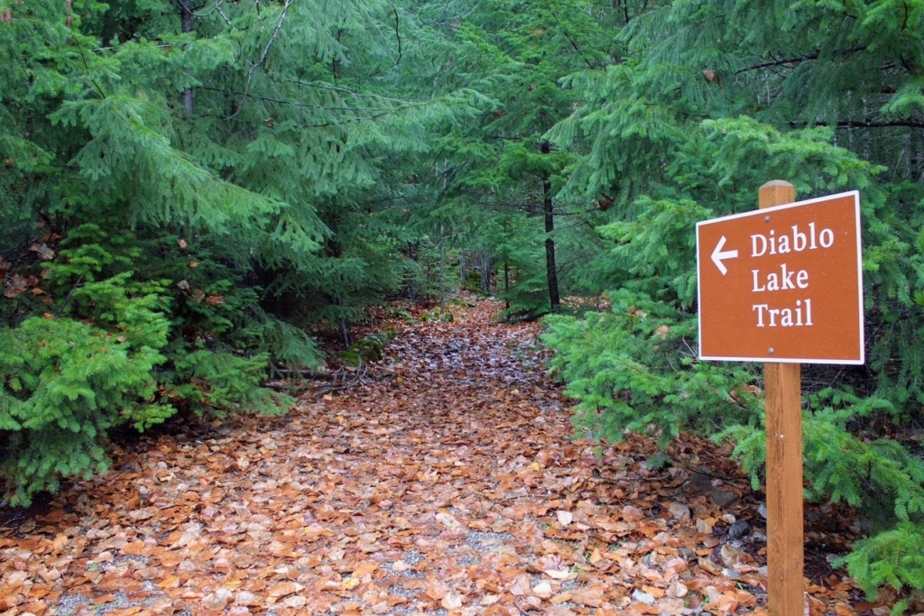
The smell of rain
One of the first smells you might notice is that familiar earthy smell after a rain. It even has a name: petrichor. The word sounds complicated, but the basic idea isn’t. During dry weather, plants release oils and soil microbes produce compounds that collect in the ground.
One especially important compound is called geosmin, which is made by microorganisms living in soil. Our noses are actually really good at picking up geosmin, even in very small amounts, which is one reason you can notice that earthy smell almost immediately after a rain.
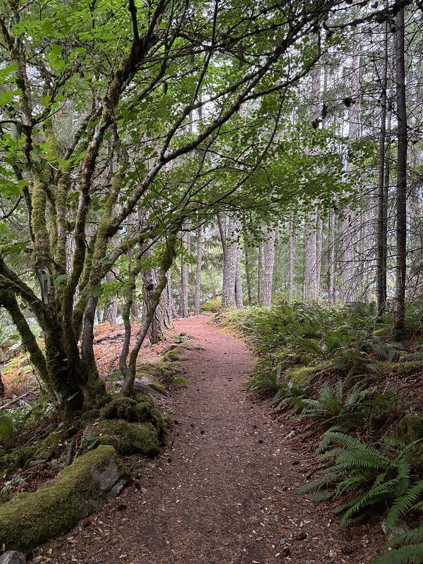
When rain finally arrives, especially after a dry stretch, raindrops hit dusty soil and disturb those compounds. Tiny droplets and particles can become airborne and drift upward. Suddenly, all those smells from the forest floor are floating around you.
Why the North Cascades smell especially good
The forests of the North Cascades have plenty of ingredients to make that autumn smell.
Think about a hike you’ve taken in the North Cascades. Maybe you’ve moseyed up Thunder Creek beneath the old-growth trees, wandered around the Environmental Learning Center, or made your way along Deer Creek Loop toward the waterfall. As you walk, you are beneath Douglas-firs, western hemlocks, cedars, and other conifers. The forest floor is covered with needles, leaves, twigs, bark, moss, and decaying plants. Add cool autumn temperatures and plenty of moisture, and you have an excellent recipe for interesting smells. Conifer needles contain aromatic oils and resins. When needles fall and break down, some of those chemicals contribute woody, fresh, or resinous aromas.
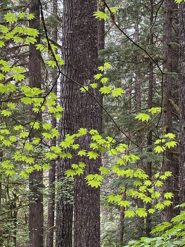
Then there’s the leaf litter, the layer of leaves, needles, twigs, and other plant material covering the forest floor. It might look like a pile of dead leaves, but there’s actually a lot going on underneath. Fungi, bacteria, and other decomposers are busy breaking all of that material down and returning nutrients to the soil. As they do their job, the chemicals inside those leaves change. Some of the compounds released during decomposition contribute to the earthy, musty smell we associate with autumn.
So when you smell that rich forest-floor scent on a North Cascades hike, you’re smelling an ecosystem at work.
Rain + dust = forest magic
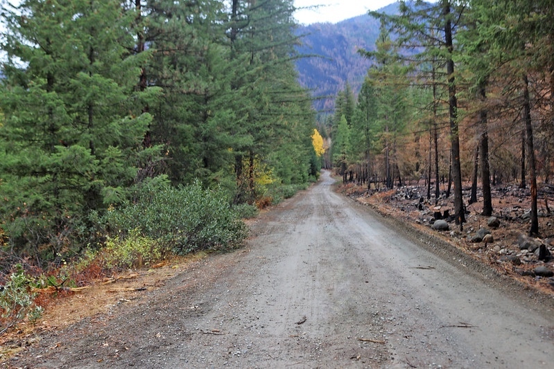
There’s another cool trick happening when rain hits dry ground. Raindrops landing on dusty or porous soil can trap tiny pockets of air. When those bubbles burst, they can fling microscopic particles and aromatic compounds into the air. Those particles can carry earthy smells straight to your nose. So that wonderful “rain smell” isn’t really the rain itself. The rain is helping release compounds from the soil and carry them into the air where we can smell them.
A forest you can smell
Scientists actually have a word for these seasonal changes: phenology. It’s the study of how plants, animals, and ecosystems respond to the changing seasons. And in the North Cascades, autumn brings plenty of changes to notice. So next time you’re hiking in the North Cascades after a fall rain, take a second to stop and smell the forest. Notice the smell of wet bark, crushed needles, damp soil, moss, and fallen leaves. There’s a lot more going on in that earthy smell than you might think. That cozy autumn scent is really a combination of biology and chemistry, microbes making geosmin, plants releasing aromatic compounds, fungi breaking down fallen leaves, and raindrops stirring everything together.
Pretty impressive for a puddle, a pile of leaves, and some dirt.
Photos by Jodi Broughton, Mariassa Bluestein and NCI
The post From the Trail: Why Autumn Smells So Good in the North Cascades first appeared on North Cascades Institute.
]]>The post Welcome to our Fall 2026 Creative Residents! first appeared on North Cascades Institute.
]]>
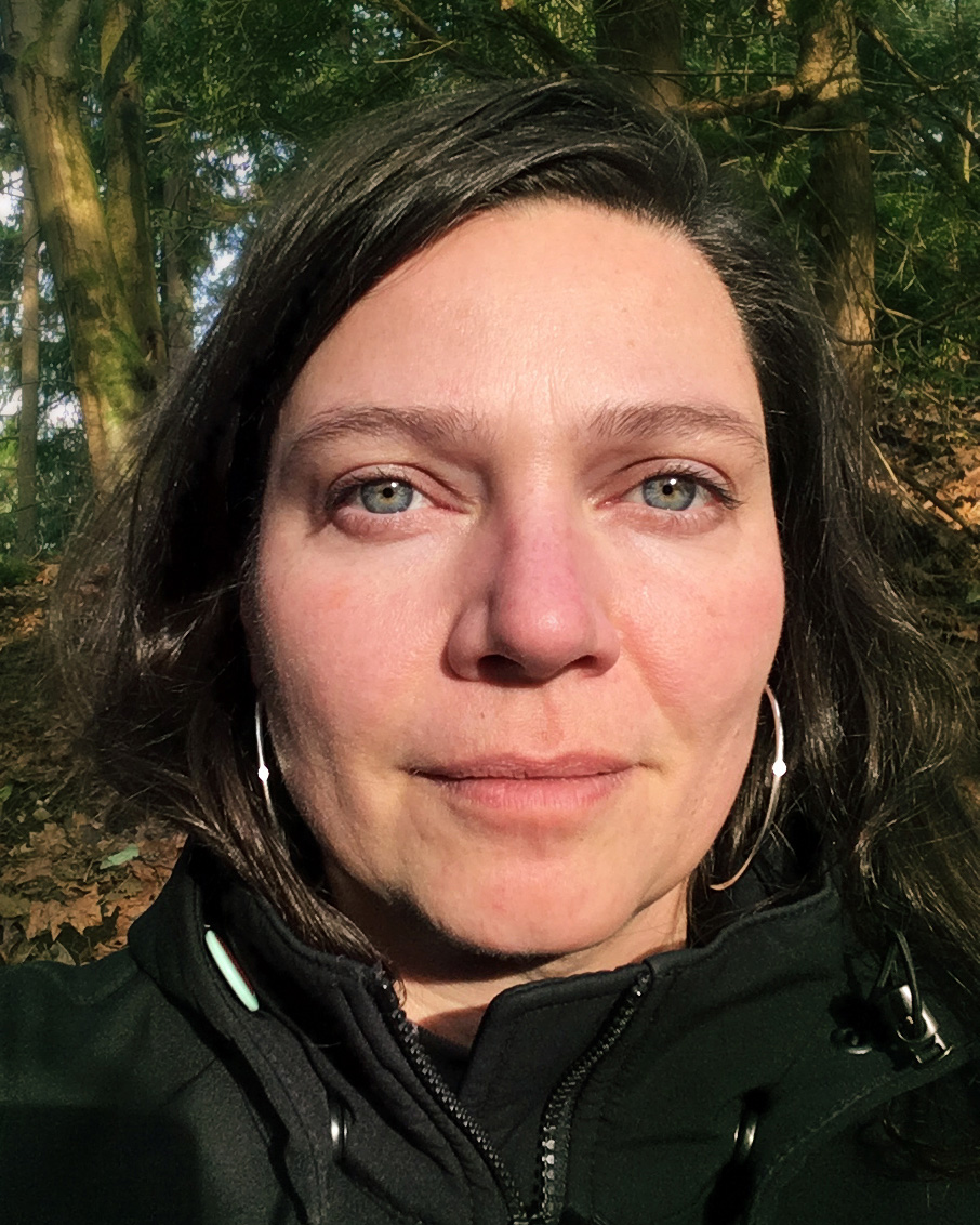 Melinda Hurst Frye photographs the ecology of the forest floor, witnessing the cyclical life found within the lush biome of the Pacific Northwest. By embracing the flatbed scanner as a camera, Hurst Frye welcomes the slowness of the process for observation, evidence of the passage of time, and connection to the protagonists and assemblages of the understory.
Hurst Frye’s work has been featured in publications for both art and science, such as WIRED and Orion Magazine, and varied exhibitions that include the Bainbridge Island Museum of Art and Museum of Northwest Art, as well as in collections including the University of Oregon, the Summit/Seattle Convention Center, King County, and the Port of Seattle at SEA. 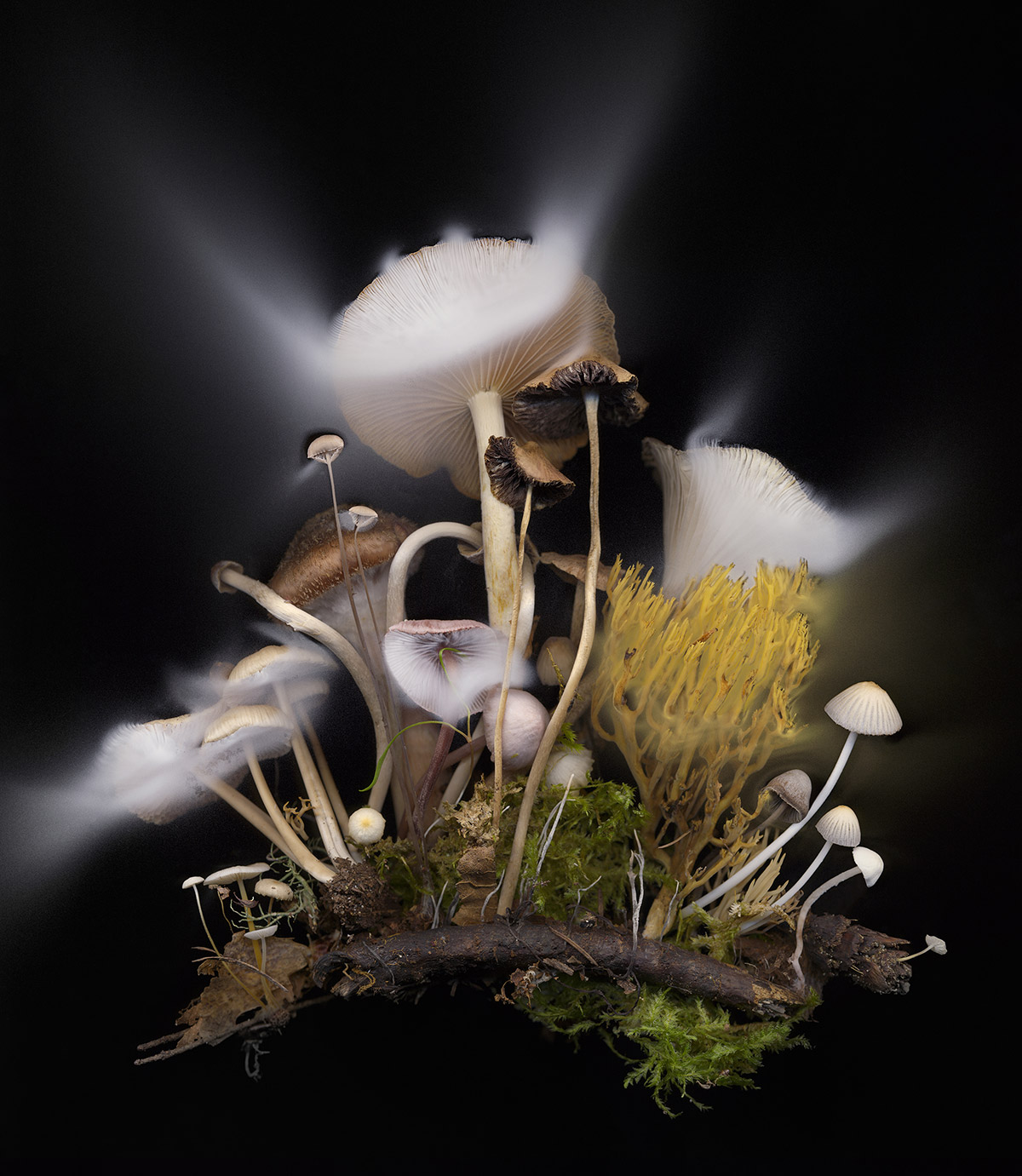
Melinda holds an MFA from the Savannah College of Art and Design, teaches regularly in the Seattle area, and is represented by J. Rinehart Gallery.
 Julie Kim 김미정 is a Seattle based, Korean-American artist. She creates multi-layered watercolor paintings that explore themes of wholeness, transformation, and healing. Her paintings reflect both inner and outer landscapes, guided by an internal practice of slowness and presence.
Her process includes foraging natural rocks and minerals to create handmade earth pigments and paints. More than a material practice, this becomes a collaboration and dialogue with the land — infusing each painting with a sense of place, time, and the natural elements. Painting becomes a way of bridging the natural and human-made, the wild and urban, fluidity and structure.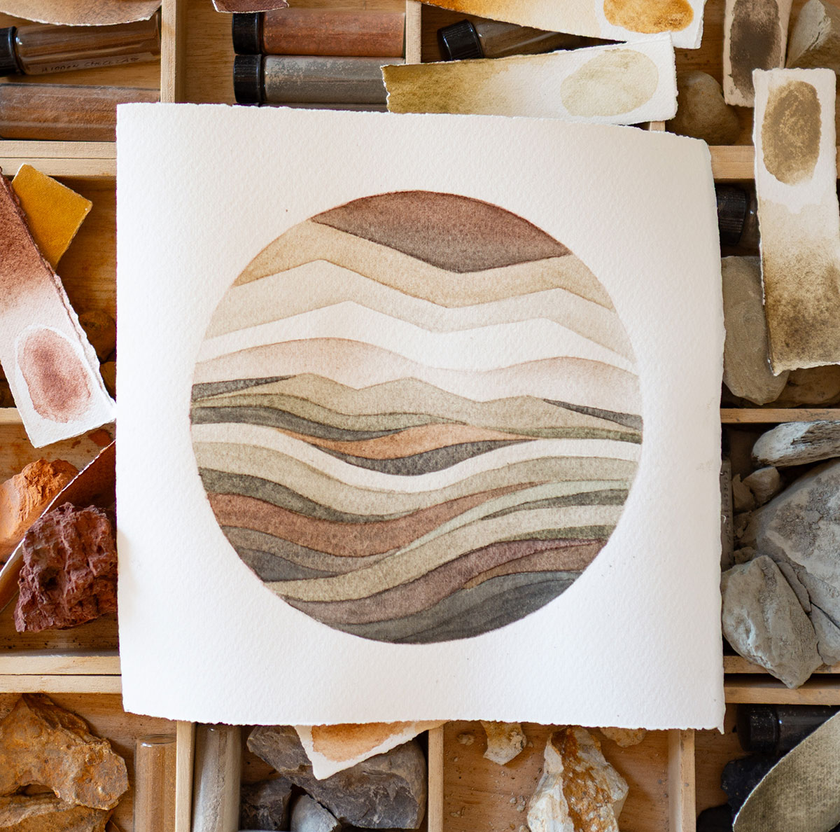
Practices of movement and healing arts deeply inform her. As a student of yoga, dance, music, and the mind-body relationship, she approaches painting as a somatic and intuitive process, allowing sensation, rhythm, and stillness to guide her compositions.
 Claire Thompson is a former longtime seasonal trail worker on the Okanogan-Wenatchee National Forest. She holds an MFA in Nature Writing from Western Colorado University and an MS in Environmental Studies from the University of Montana, and has taught writing at the University of Montana and Wenatchee Valley College.
Her work is forthcoming in River Teeth and the anthology Cascadia Works, and has appeared in, among others, High Country News, Out There Outdoors, and Terrain, where she was a featured contributor to the 2022 “Lookout: Writing + Art About Wildfire” series and a finalist in the 2021 nonfiction contest. Claire grew up in Seattle and lives in Leavenworth, where she currently works at a bookstore and a brewery. She is at work on a researched memoir about the past, present, and future of public-lands stewardship.
Keep an eye out for updates from Melinda, Julie, and Claire as they work on their respective projects in the heart of the North Cascades. We’ll be sharing their work and experiences here.
Now Accepting Spring 2027 Proposals
Interested in joining the North Cascades Institute community to work on your own creative project? We are now soliciting proposals for Spring 2027 residencies. The priority deadline for proposals is October 30, 2026. If you have questions, please contact Nathan Drapela, Learning Center Programs Manager at nathan_drapela@ncascades.org.
The post Welcome to our Fall 2026 Creative Residents! first appeared on North Cascades Institute.
]]>The post The North Cascade Glacier Climate Project: Observing Glacier Change with Art and Science Since 1984 first appeared on North Cascades Institute.
]]>To better understand the rate of glacier loss and its impact on our region’s watersheds, I founded the North Cascade Glacier Climate Project (NCGCP) and led our first field season in 1984. The project’s goal was ambitious: to document the response of glaciers to climate change across the North Cascade Range for 50 years. The North Cascade Institute was founded shortly thereafter in 1986 with a goal of connecting people, nature and community through science, art, literature and the hands-on study of the natural and cultural history of the Pacific Northwest.
To foster connection with the North Cascades natural environment we backpack to every glacier, using no helicopter support, and leave no equipment in place. By 2005 it was evident that the profound changes that we were observing could be communicated with science information alone.We evolved into a glacier science and art expedition team. Incorporating artists was an unusual approach for science programs at the time, that has now become a desired approach. In recent years we have invited a painters, fiber artists, illustrators, writers, printmakers, photographers, and even a cake artist to join us. The result has been a series of exhibits “Shaped By Ice” that has leaned into the synergy of art and science to deepen our connection with the public intellectually and emotionally to glacier change.
In 2026 we embark on our 43rd summer of observations after a mild winter with limited snowpack and a warm spring leading to a snow cover declining to mid-summer levels by early June.
Measuring Glacier Change
Mass balance is the difference between “accumulation” (the amount of snow and ice added to the glacier each year) and “ablation” (the amount of snow and ice lost on the glacier each year). When ablation consistently exceeds accumulation, the glacier shrinks. We measure annual mass balance which is noted as the most sensitive climate variable for glaciers.
To determine mass balance we measure snow depth across the glacier using either a steel probe that can be driven through the snowpack or measuring the annual snow layer on the vertical wall of a crevasse. We observe ablation (melt) by observing the rate of snow depth loss using stakes emplaced for a brief period and observing the migration of the snow line. From 1984-2013 glaciers lost mass (avergae thinning) at a rate of 0.4 m/year. From 2014-2025 glaciers have lost mass at a rate of 1.5 m/year. Given that the average glacier was 50-60 m thick in 1984. The loss of 25-30 m represents a 40-50% loss of glacier volume.
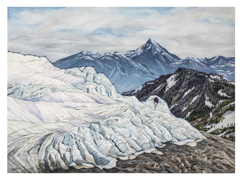
Several glaciers we measured mass balance on annually have disappeared including Ice Worm (2023), Lewis (1993) and Spider Glacier (2005).
In 1984 and 1985 we visited a network of 47 glaciers that we planned to return to every five years to understand how fast they were expanding or shrinking. Recognize that in the 1970s most large North Cascade glaciers were advancing, including all major glaciers on Mount Baker. In 1984 three of the glaciers were still advancing. By 1993 all 47 glaciers were retreating. In 2025, 12 of the 47 glaciers no longer exist.
The NCGCP annually measures three glaciers on Mount Baker (Easton, Rainbow, and Sholes), and periodically measure five others (Deming, Boulder, Coleman, Mazama, and Squak). By 2025, the average retreat of the eight glaciers since 1984 was 710 meters. From 1984 to 2025, the area of Mount Baker glaciers declined by 20-25% and experienced 24-27 meters of glacier thinning. In turn, glacier velocity (or, the rate at which these glaciers move, indicating the decline in mass balance) has declined, as has crevassing. The thinning also reveals new bedrock even high on the mountain.
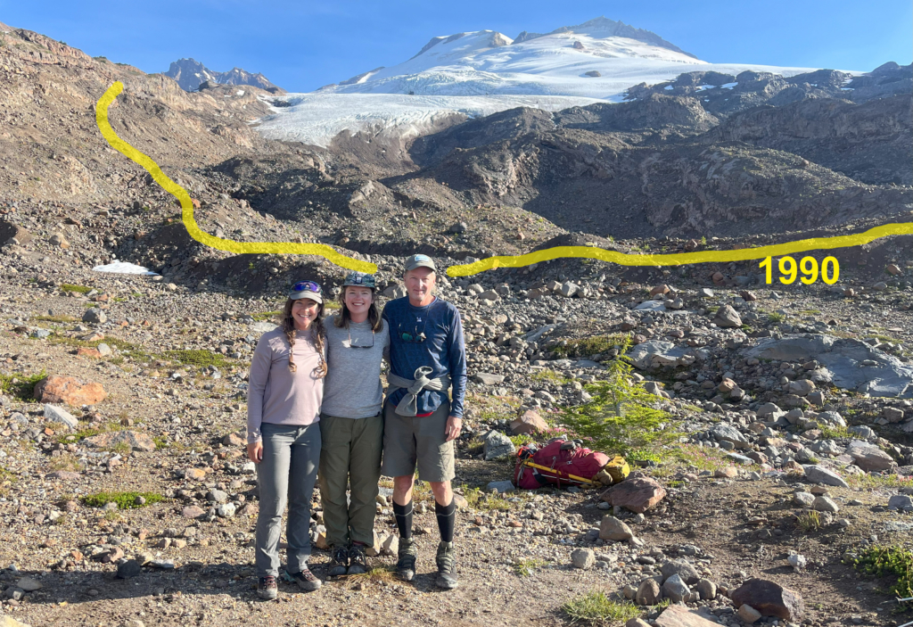
The result is a North Cascade Range with less glacier cover and more lose rock on the newly deglaciated terrain. There is also an impact on our glacier fed alpine rivers. The combination of glacier loss and streamflow changes is best illustrated in the Skykomish River Basin.
Skykomish Valley
Glaciers play an important role for rivers by buffering low flow periods and regulating stream temperatures during late summer. Without glaciers, the late-summer water supply diminishes and stream temperatures rise, which can reduce water quality and create unsuitable habitat for aquatic life. In the mid 1980s NCGCP identified nine glaciers in the Skykomish River basin that had active crevassing, an indication of thick and healthy ice accumulation, and sufficient area to be classified as a glacier. Between 2005 to 2023, six of these glaciers disappeared.
Two of the three glaciers that remain – the Lynch and Columbia Glaciers – now comprise 88% of the basin’s glaciated area. From 1984 to 2013, the mean annual mass balance on the Lynch and Columbia Glaciers was –0.38 meters per year (meaning, on average, they lost 0.38 meters per year). From 2014 to 2025, the mean annual mass balance decreased to –1.55 meters per year. The basin’s third glacier, Foss Glacier, has lost 85% of its area since 1958 and has almost disappeared, with 2026 being the likely year of its loss.
The basin is on a trajectory to lose all its remaining glaciers in the next two to three decades. This will complete the transition from a glaciated to an unglaciated watershed, with no capacity to restore any of the glaciers in the foreseeable future.
In the Skykomish River, ongoing glacier loss has resulted in lower late-summer streamflow and warmer stream temperatures. Since 1986, there have been 15 separate years when streamflow in the Skykomish River was significantly low (below 14 cubic meters per second) for 10 consecutive days, and since 2008, the river has repeatedly exceeded its maximum temperature threshold of 16oC (meaning that, under the Clean Water Act, the river violated water quality standards and was deemed “impaired”).
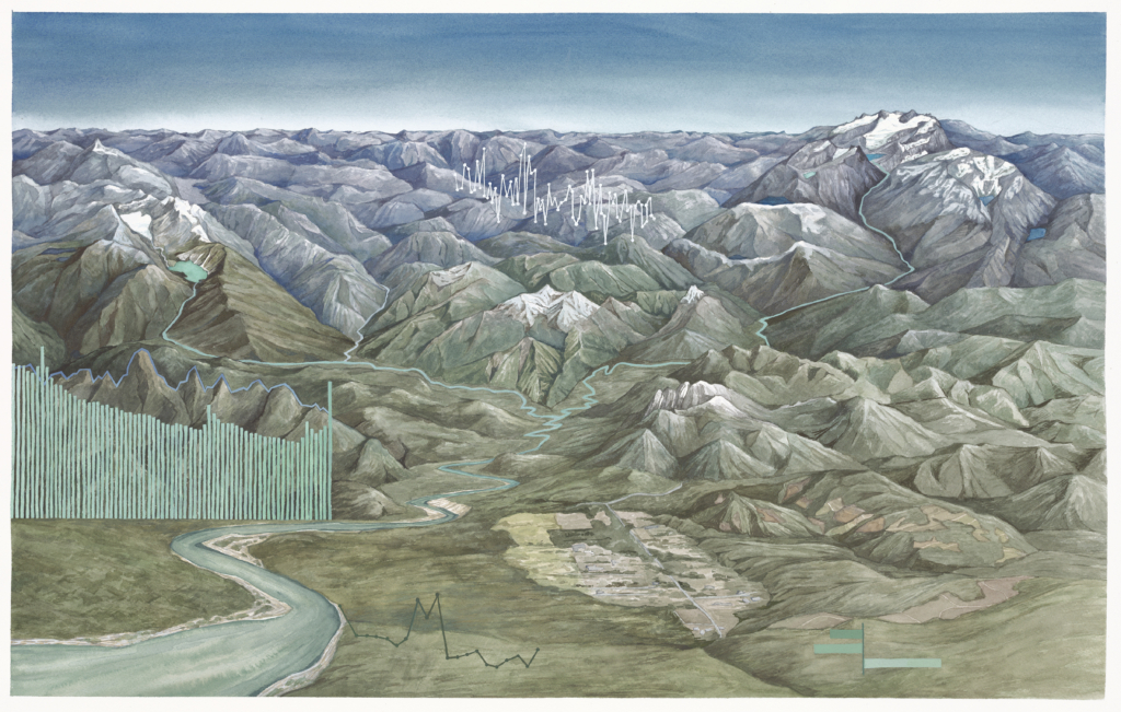
From the Glaciers to the Sea: this painting tells the story of this watershed fed by North Cascade glaciers that flow out into the Puget Sound. The snowpack and glaciers in the mountains in this region provide crucial meltwater to river systems, many of which connect critically to the ocean. Columbia Glacier is seen on the left of the painting, with the beautiful Blanca Lake beneath. This is one of three glaciers remaining in this region, the other five have recently disappeared. On the right side is the Alpine Lakes Wilderness, three of the nine glaciers in this complex remain. Most recently lost was the Iceworm Glacier, in 2023.
The large bar graph in this piece shows Skykomish River discharge (the volume of water) from mid July to late September in 2023. The decrease in water over the dry, hot summer period is evident. The line graph that makes up the mountain above the bars shows the temperature of the river at this same time, highlighting heat wave events. When the temperature spikes, and when the river levels drop, a critical threshold is reached for salmon and other species. This highlights the importance of glaciers in acting as a buffer during drought and heat events.
The Skykomish River is a tributary of the Snohomish River, where efforts are being made by the Stillaguamish Tribe to improve conditions for salmon. These important efforts may be significantly offset by continued glacier loss.
Looking ahead
Across the North Cascade Range, we’ve witnessed a 35-50% loss of ice in the past decade, translating to a rate of 1.5 meters of ice thickness lost per year. For many of the relatively small alpine glaciers in the North Cascades, this rate of loss has resulted in extinction.
In addition to environmental consequences, glacier loss significantly impacts our recreational experiences by altering climbing routes, increasing rockfall risk in newly deglaciated areas, and creating unstable ice caves. No longer can you stand atop a Cascade peak in late summer and look over a range of glacier-clad summits.
At the current rate of loss, it’s uncertain whether fifty years from now any glaciers will remain. The possibility depends on the choices we make and the evolution of our energy production and consumption.
You can help protect our glaciers by:
Contributing to the research. Share your observations with the North Cascade Glacier Climate Project by emailing mspelto@nichols.edu or tagging us on Instagram (@mspelto and @jillpelto). We cannot reach all of the glaciers we would like observations of.
Reduce Footprint: Identify how you can reduce your carbon footprint and implement those changes that in particular add net value now.
Participating in local climate advocacy. Work proactively with organizations that amplify your voice in asking lawmakers to support policies that protect our cherished landscapes, and educate your community about the impact of sustainable lifestyle choices on our glaciers.
The post The North Cascade Glacier Climate Project: Observing Glacier Change with Art and Science Since 1984 first appeared on North Cascades Institute.
]]>